You are viewing the free Snapshot. Dashboard puts rankings, rents, projects and services on one screen, and Full adds every chapter with charts and maps. Dashboard and Full are included with AreaSearch Operator and Pro, or unlocked by the area's Area Expert. You need to log in to open them.
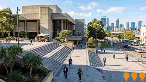
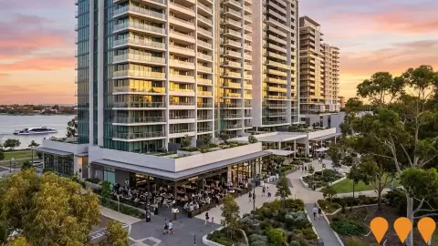
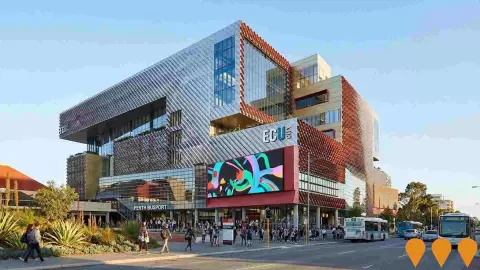
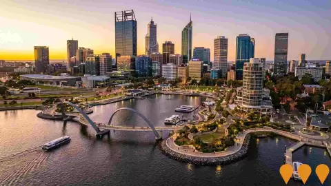
Located in the heart of the Perth CBD, the suburb of Perth (WA) is estimated by AreaSearch to have around 17,555 residents as of Aug 2026. That estimate is derived from aggregated SA2-level ERP counts, which are released yearly, together with national address file data updated each quarter. Population has grown by 3,885 people (28.4%) since the 2021 Census, which recorded 13,670 people. The community is driven by young professionals, with population density and growth drivers well above average, and the area features an active, dense development environment.
Residents of the suburb of Perth (WA) include a high proportion of young adults, and the working-age population is made up largely of lone person and group households. Educational qualifications across the community are strong, the population has a high share born overseas, and the renting population is above average. The area is exceptionally well educated and highly culturally diverse, and in terms of population growth it ranks in the top 10% of areas nationally.
Read the analysisShow less
Download a free snapshot of Perth (WA) or order the area report
Free with an AreaSearch account. Pro is not needed.Free. Built in your browser.
The analysis, national rankings and who lives there.
About Perth (WA)
Located in the heart of the Perth CBD, the suburb of Perth (WA) is estimated by AreaSearch to have around 17,555 residents as of Aug 2026. That estimate is derived from aggregated SA2-level ERP counts, which are released yearly, together with national address file data updated each quarter. Population has grown by 3,885 people (28.4%) since the 2021 Census, which recorded 13,670 people. The community is driven by young professionals, with population density and growth drivers well above average, and the area features an active, dense development environment.
Residents of the suburb of Perth (WA) include a high proportion of young adults, and the working-age population is made up largely of lone person and group households. Educational qualifications across the community are strong, the population has a high share born overseas, and the renting population is above average. The area is exceptionally well educated and highly culturally diverse, and in terms of population growth it ranks in the top 10% of areas nationally.
Read the analysisShow less
Estimated resident population by year (ABS, not Census counts): 6,429 in 2006 and 17,534 in 2025. The dashed segment ends at the AreaSearch estimate for Aug 2026: 17,555 (ABS June 2025 base).
Each bar and spoke is a national percentile; the dashed ring is the typical area. 99th = higher than 99 in every 100 neighbourhood-sized areas across Australia (ABS SA2 areas). Higher means more of the measure, not necessarily better. Orange marks the top three measures where a higher percentile is better; not Age, Housing or Housing Cost.
Perth lies within the top 9% of areas nationally in terms of population growth performance according to AreaSearch analysis of short and medium-term trends.
The economic profile demonstrates above-average performance, with income metrics exceeding national benchmarks based on AreaSearch comparative assessment.
Why Perth (WA) stands out
Driven by young professionals
Population density and growth drivers well above average
A dense and active development area
Strong educational qualifications across the community
High population level born overseas
Above-average renting population
02Market and pipeline
Rents, sale prices and what is being built.
Rents in Perth (WA)
The median rent in Perth (WA) is $610 a week, up 1.3% over 12 months to Sep 2026 and 16% below Greater Perth.
Lodged-bond median rent a week, with the area's own change on a year ago, to Sep 2026.
Perth (WA)$610+1.3%
Perth City$689+3.2%
Perth - Inner$724+4.0%
Greater Perth$723+6.5%
WA$714+7.0%
16% below Greater Perth on median weekly rent
Median rent
$610 a week
Lodged-bond median (to Sep 2026), +1.3% over 12 months
Sales and rents in Perth (WA): key figures
Measure
Value
Source and date
National percentile
Median rent
$610 a week
Rental bond lodgements, median for the 12 months to Sep 2026
Change in median rent over 12 months
+1.3%
Rental bond lodgements, median for the 12 months to Sep 2026
Median rent, Perth City
$689 a week
Rental bond lodgements, median for the 12 months to Sep 2026
Change in median rent, Perth City, over 12 months
+3.2%
Rental bond lodgements, median for the 12 months to Sep 2026
Median rent, Perth - Inner
$724 a week
Rental bond lodgements, median for the 12 months to Sep 2026
Show 5 more sales and rents figuresShow fewer
Sales and rents in Perth (WA): key figures, continued
Measure
Value
Source and date
National percentile
Change in median rent, Perth - Inner, over 12 months
+4.0%
Rental bond lodgements, median for the 12 months to Sep 2026
Median rent, Greater Perth
$723 a week
Rental bond lodgements, median for the 12 months to Sep 2026
Change in median rent, Greater Perth, over 12 months
+6.5%
Rental bond lodgements, median for the 12 months to Sep 2026
Median rent, WA
$714 a week
Rental bond lodgements, median for the 12 months to Sep 2026
Change in median rent, WA, over 12 months
+7.0%
Rental bond lodgements, median for the 12 months to Sep 2026
Development applications mapped around Perth (WA)
See the development applications we track, then draw your own catchment and map retailers, health, schools and more.
Approved 7
Under assessment 9
Other 27
48tracked
Status of the 48 tracked applications: 9 approved, 12 under assessment, 27 other (refused, withdrawn or no status).
Images marked AI impression are illustrative only and not photographs of the project; follow the project links for actual imagery. Original imagery? Contact us.
Estimated completion year of the 74 projects in and around the area that are not yet completed and have one: 2025 1, 2026 19, 2027 24, 2028 12, 2029 6, 2030 2, 2031 0, 2032 1, 2033 0, 2034 3, 2035 2, 2036 4. 10 have no completion year.
Development applications
AreaSearch has tracked 48 substantial development applications lodged in and around Perth (WA) over the period covered (about 2.4 years), 42 in the last 12 months; 12 are recorded as under assessment. Coverage varies by council.
Tracked applications by year
Applications per year (dashed: part year): 2024 (part year) 1, 2025 5, 2026 (to Oct) 42.
Tracked by AreaSearch, in and around the area, period covered (about 2.4 years)
Tracked, last 12 months
42
Tracked by AreaSearch, in and around the area
ABS building approvals
4.1 per 1,000 people
ABS building approvals
51st percentile nationally
Average approvals a year
65
ABS building approvals
68th percentile nationally
Applications approved
9
Tracked by AreaSearch, in and around the area, period covered (about 2.4 years)
Applications under assessment
12
Tracked by AreaSearch, in and around the area, period covered (about 2.4 years)
Questions about infrastructure in Perth (WA)
What are some of the major infrastructure and planning changes likely to influence the suburb of Perth?
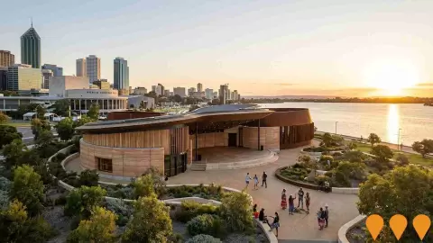
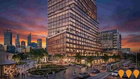
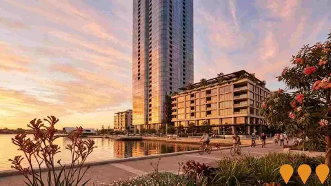
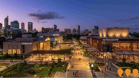
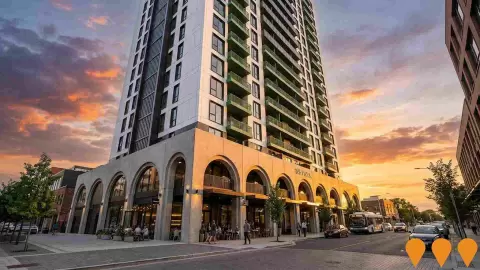
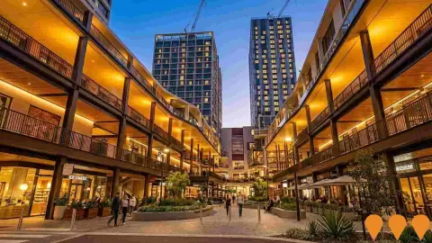
Key infrastructure and planning changes likely to influence the suburb of Perth include: Perth City Link Redevelopment (Construction); 21 The Esplanade Mixed-Use Tower (Construction); Perth Cultural Centre Rejuvenation (Construction); Aboriginal Cultural Centre (Planning); and Sydney Charles Quarter (Construction). These projects represent significant developments that will shape the area's future infrastructure landscape.
What types of infrastructure projects are impacting the suburb of Perth?
Infrastructure development impacting the suburb of Perth spans multiple sectors including Arts & Culture, Communities, Precincts & Urban Renewal, and Residential Development, among others.
Development in Perth (WA)
AreaSearch's development drivers ranking places residential development activity in Perth higher than 96% of real estate markets across the country.
Questions about development in Perth (WA)
How many dwelling approvals have occurred in the suburb of Perth recently?
Dwelling approval activity in the suburb of Perth area has seen 279 residential approvals over the past two financial years, based on AreaSearch's SA2 aggregation method. The suburb of Perth's current population of 17,555 has been supported by 65 approvals on average over recent years.
How does the suburb of Perth's development activity compare to Greater Perth?
The suburb of Perth has seen 4.1 approval per 1,000 people in recent years, compared to 7.4 approvals in Greater Perth. This means that one dwelling has been approved for every 123 people in the suburb of Perth, compared to one for every 118 in Greater Perth.
What is the outlook for development in Perth (WA)?
The long-run outlook for development is part of AreaSearch Operator and Pro. Log in to see the forecast detail in Full.
Show all 5 questionsShow fewerWhat has been the trend in development approvals over the past five years in the suburb of Perth?
Looking at development activity over the past five years, the suburb of Perth's approval levels have been significantly above the yearly average of 65, indicating strong recent growth in development activity.
How does recent development compare to population growth in the suburb of Perth?
Over the past five years, the population in the suburb of Perth has grown by approximately 3,360 people, while 327 residential approvals were recorded. This equates to a ratio of 10.3 people added for each new dwelling approval. This high ratio suggests strong population growth relative to housing supply, potentially indicating unmet housing demand.
03People
Population, age, income, work, education and more.
99th = higher than 99 in every 100 neighbourhood-sized areas across Australia (ABS SA2 areas). Higher means more of the measure, not necessarily better.
Population in Perth (WA)
Data: Aug 2026 estimate, from the ABS June 2025 base
Perth lies within the top 9% of areas nationally in terms of population growth performance according to AreaSearch analysis of short and medium-term trends.
Population in Perth (WA): key figures
Measure
Value
Source and date
National percentile
Population
17,555
AreaSearch estimate, Aug 2026, from the ABS June 2025 base
Growth since 2021 Census
+28.4%
AreaSearch estimate, Aug 2026, against the 2021 Census
94th percentile nationally
Population density
3,854 per km²
AreaSearch estimate, Aug 2026, from the ABS June 2025 base
91st percentile nationally
Average yearly growth, 2020 to 2025
+4.3%
ABS estimated resident population series to June 2025
Average yearly growth, 2015 to 2025
+3.9%
ABS estimated resident population series to June 2025
Show 5 more population figuresShow fewer
Population in Perth (WA): key figures, continued
Measure
Value
Source and date
National percentile
Population at the 2021 Census
13,670
2021 Census
Residents added since the 2021 Census
3,885
AreaSearch estimate, Aug 2026, against the 2021 Census
Average yearly growth, 2022 to 2025
+5.8%
ABS estimated resident population series to June 2025
Population growth, 2024 to 2025
+2.9%
ABS estimated resident population series to June 2025
Land area
4.55 km²
AreaSearch boundary analysis
Questions about population in Perth (WA)
What is the latest population estimate for the suburb of Perth?
Total population for the suburb of Perth was estimated to be approximately 17,555 as at Aug 2026. This is based upon an estimated resident population of 17,534 from the ABS up to June 2025.
How has the population in the suburb of Perth changed since 2021?
The suburb of perth has added approximately 3,885 people and shown a 28.42% increase from the 13,670 people recorded at the 2021 Census period.
What is the population density in the suburb of Perth?
The population density in the suburb of Perth is estimated at 3,858 persons per square kilometre based on the latest population estimate.
Show all 5 questionsShow fewerHow much has the population grown over the past 10 years in the suburb of Perth?
Over the past 10 years, the population in the suburb of Perth has shown a compound annual growth rate of 3.9% per annum.
What are the main drivers of population growth in the suburb of Perth?
Population growth in the suburb of Perth is driven by: Overseas migration (93.0%), Natural increase (7.000000000000001%), Interstate migration (0.0%). The primary driver is Overseas migration, contributing 93.0% of overall population gains.
Age in Perth (WA)
Data: Aug 2026 estimate, from the ABS June 2025 base
Perth's young demographic places it in the bottom 14% of areas nationwide.
Age in Perth (WA): key figures
Measure
Value
Source and date
National percentile
Median age
32 years
ABS estimated resident population age profile (June 2025), scaled to the Aug 2026 AreaSearch estimate
14th percentile nationally
Aged 65 and over
8.1%
ABS estimated resident population age profile (June 2025), scaled to the Aug 2026 AreaSearch estimate
Children under 15
6.0%
ABS estimated resident population age profile (June 2025), scaled to the Aug 2026 AreaSearch estimate
Aged 15 to 34
50.8%
ABS estimated resident population age profile (June 2025), scaled to the Aug 2026 AreaSearch estimate
Aged 25 to 64
73.4%
ABS estimated resident population age profile (June 2025), scaled to the Aug 2026 AreaSearch estimate
Show 11 more age figuresShow fewer
Age in Perth (WA): key figures, continued
Measure
Value
Source and date
National percentile
Median age at the 2021 Census
33 years
2021 Census
Aged 0 to 4
2.7%
ABS estimated resident population age profile (June 2025), scaled to the Aug 2026 AreaSearch estimate
Aged 5 to 14
3.3%
ABS estimated resident population age profile (June 2025), scaled to the Aug 2026 AreaSearch estimate
Aged 15 to 24
12.5%
ABS estimated resident population age profile (June 2025), scaled to the Aug 2026 AreaSearch estimate
Aged 25 to 34
38.3%
ABS estimated resident population age profile (June 2025), scaled to the Aug 2026 AreaSearch estimate
Aged 35 to 44
19.9%
ABS estimated resident population age profile (June 2025), scaled to the Aug 2026 AreaSearch estimate
Aged 45 to 54
8.4%
ABS estimated resident population age profile (June 2025), scaled to the Aug 2026 AreaSearch estimate
Aged 55 to 64
6.8%
ABS estimated resident population age profile (June 2025), scaled to the Aug 2026 AreaSearch estimate
Aged 65 to 74
4.8%
ABS estimated resident population age profile (June 2025), scaled to the Aug 2026 AreaSearch estimate
Aged 75 to 84
2.4%
ABS estimated resident population age profile (June 2025), scaled to the Aug 2026 AreaSearch estimate
Aged 85 and over
0.9%
ABS estimated resident population age profile (June 2025), scaled to the Aug 2026 AreaSearch estimate
Questions about age in Perth (WA)
What is the median age in the suburb of Perth?
AreaSearch estimates the median age in the suburb of Perth at 32 years as at August 2026. That is down from the 2021 Census figure of 33 years, with AreaSearch updating the age profile for population change recorded since the Census.
How does the suburb of Perth's median age compare to Greater Perth and Australia?
At an estimated 32 years as at August 2026, Perth is 5 years younger than the Greater Perth 2021 Census average (37 years) and 6 years younger than the national Census average (38 years).
What age groups are over-represented in the suburb of Perth?
On AreaSearch estimates updated to August 2026, the most over-represented age group in the suburb of Perth compared to the Greater Perth region is the 25 - 34 group, making up 38.3% of the population.
Show all 7 questionsShow fewerWhat age groups are under-represented in the suburb of Perth?
On AreaSearch estimates updated to August 2026, the most under-represented age group in the suburb of Perth compared to the Greater Perth region is the 5 - 14 group, making up 3.3% of the population.
Are there age groups with notable population variances?
Yes, certain age groups in the suburb of Perth show significant variance compared to Greater Perth. The most over-represented age group is 25-34 year-olds (38.3% vs 15.8%). The most under-represented age groups are 5-14 year-olds (3.3% vs 12.2%) and 75-84 year-olds (2.4% vs 5.5%).
What is the percentage of children (0-14 years) in the suburb of Perth?
AreaSearch estimates children aged 0-14 years at 6.0% of the population in the suburb of Perth as at August 2026.
What is the percentage of older people (65+ years) in the suburb of Perth?
AreaSearch estimates people aged 65 and over at 8.1% of the population in the suburb of Perth as at August 2026.
Income in Perth (WA)
Data: ATO FY 2024 and 2021 Census
The economic profile demonstrates above-average performance, with income metrics exceeding national benchmarks based on AreaSearch comparative assessment.
Income in Perth (WA): key figures from ATO taxation data (annual)
Measure
Value
Source and date
National percentile
Median taxable income (ATO)
$58,085 a year
ATO FY-24, annual
45th percentile nationally
Average taxable income
$83,279 a year
ATO FY-24, annual
Income in Perth (WA): key figures from the 2021 Census (weekly income)
Measure
Value
Source and date
National percentile
Census household income / week
$1,960
2021 Census, weekly
63rd percentile nationally
Census personal income / week
$1,139
2021 Census, weekly
87th percentile nationally
High-income households
26.9%
2021 Census
Census family income / week
$2,494
2021 Census, weekly
Low-income households
18.0%
2021 Census
Questions about income in Perth (WA)
What is the median taxable income in the suburb of Perth?
Based on Wage Price Index adjustments to June 2026, the estimated median taxable income in the suburb of Perth is approximately $62,174. The official ATO data from FY-24 recorded a median of $58,085.
What is the average taxable income in the suburb of Perth?
Based on Wage Price Index adjustments to June 2026, the estimated average taxable income in the suburb of Perth is approximately $89,142. The official ATO data from FY-24 recorded an average of $83,279.
How does the median taxable income in the suburb of Perth compare to Greater Perth?
Based on Wage Price Index adjustments to June 2026, the estimated median taxable income in the suburb of Perth is approximately $62,174 compared to $68,556 in Greater Perth. The official ATO data from FY-24 shows $58,085 and $64,047 respectively.
Show all 12 questionsShow fewerHow does the average taxable income in the suburb of Perth compare to Greater Perth?
Based on Wage Price Index adjustments to June 2026, the estimated average taxable income in the suburb of Perth is approximately $89,142 compared to $90,565 in Greater Perth. The official ATO data from FY-24 shows $83,279 and $84,609 respectively.
What are the main income cohorts in the suburb of Perth according to the 2021 Census?
As per the 2021 Census, the weekly household income bracket containing the largest proportion of the suburb of Perth's households (~36.2% / 2,170 households) is the $1,500 - 2,999 cohort.
How do the main income cohorts in the suburb of Perth compare to Greater Perth?
The largest weekly household income cohort in the suburb of Perth is the $1,500 - 2,999 group, representing about 36.2% of households. In comparison, Greater Perth's largest household income cohort is the $1,500 - 2,999 group, representing 32.0% of its households, according to the 2021 Census.
What is the median household income in the suburb of Perth according to the 2021 Census?
The 2021 Census data indicates that the median household income in the suburb of Perth is $1,960/wk.
What is the median family income in the suburb of Perth according to the 2021 Census?
According to the 2021 Census, the median family income in the suburb of Perth is $2,494/wk.
What is the median personal income in the suburb of Perth according to the 2021 Census?
The 2021 Census shows that the median personal income in the suburb of Perth is $1,139/wk.
How does the suburb of Perth's income rank nationally?
According to AreaSearch's aggregation of the latest postcode level ATO data released for FY-24, the suburb of Perth had a median income among taxpayers of $58,085 with the average level standing at $83,279. This is well above average nationally and compares to levels of $64,047 and $84,609 across Greater Perth respectively. Based on Wage Price Index growth of 7.04% since FY-24, current estimates would be approximately $62,174 (median) and $89,142 (average) as of June 2026.
What is the disposable income in the suburb of Perth?
The estimated disposable income in the suburb of Perth is $6,932 per year according to AreaSearch analysis.
How does the suburb of Perth's disposable income compare to Greater Perth?
The suburb of perth's disposable income is $6,932 compared to $6,842 for Greater Perth, based on AreaSearch analysis.
Employment in Perth (WA)
Employment performance in Perth has been below expectations when compared to most other areas nationally.
Employment in Perth (WA): key figures
Measure
Value
Source and date
National percentile
Unemployment rate
8.9%
ABS and DEWR labour data, compiled by AreaSearch
Workforce participation
76.9%
ABS and DEWR labour data, compiled by AreaSearch
Employed residents
11,545
ABS and DEWR labour data, compiled by AreaSearch
Daytime population
65,277
AreaSearch estimate of residents and workers present on a weekday
Labour force
12,671
ABS and DEWR labour data, compiled by AreaSearch
Questions about employment in Perth (WA)
What is the employment situation in the suburb of Perth?
As of March 2026, the suburb of Perth has approximately 11,545 employed residents with an unemployment rate of 8.9%. The elevated unemployment rate suggests challenging labour market conditions. The area faces employment challenges compared to other regions nationally.
How does the suburb of Perth's unemployment rate compare to Greater Perth?
As of March 2026, the unemployment rate in the suburb of Perth stands at 8.9%, which is 4.7 percentage points above Greater Perth's rate of 4.2%. This higher unemployment rate may indicate local labour market challenges. For comparison, the national unemployment rate is 4.2%.
What are the major employment sectors in the suburb of Perth?
The employment landscape in the suburb of Perth is dominated by several key sectors. The largest employers are professional & technical (15.9% of employment), accommodation & food (14.7%), and health care & social assistance (12.4%). Other significant employers include mining and retail trade.
Show all 8 questionsShow fewerHow has employment changed recently in the suburb of Perth?
Over the past year to March 2026, the suburb of Perth has experienced employment growth, with total employment increasing while the labour force increased. As a result, the unemployment rate has risen. By comparison, Greater Perth saw employment increased and its unemployment rate rose.
What is the workforce participation rate in the suburb of Perth?
The workforce participation rate in the suburb of Perth is 76.9%, which represents the proportion of working-age residents who are either employed or actively seeking work. This high participation rate indicates strong workforce engagement and economic vitality. The local rate leading the Greater Perth average of 69.9%, indicating stronger workforce attachment in the local area.
Which industries are over-represented in the suburb of Perth's employment market?
The suburb of perth shows notable specialisation in accommodation & food, which employs 14.7% of the local workforce compared to 6.8% across Greater Perth. With a local vs regional employment ratio of 2.2, this represents a significant industry cluster that likely serves markets beyond the local area. The area also shows above-average employment in 2 other sectors, contributing to a distinctive economic profile.
What is the outlook for employment in Perth (WA)?
The long-run outlook for employment is part of AreaSearch Operator and Pro. Log in to see the forecast detail in Full.
How does the job market in the suburb of Perth compare nationally?
The suburb of perth's employment market shows weaker performance compared to most areas nationally. This suggests the need for targeted economic development initiatives. Recent job advertisement trends show the broader employment region experienced 4.5% growth, ranking 12th out of 37 regions nationally.
Education in Perth (WA)
Data: 2021 Census
Perth demonstrates exceptional educational outcomes, ranking among the top 2% of areas nationally based on AreaSearch's comprehensive analysis of qualification and performance metrics.
Education in Perth (WA): key figures
Measure
Value
Source and date
National percentile
Bachelor qualifications
35.8%
2021 Census
95th percentile nationally
Postgraduate qualifications
14.7%
2021 Census
88th percentile nationally
University qualifications
53.9%
2021 Census
Vocational qualifications
13.9%
2021 Census
18th percentile nationally
Graduate diploma or certificate
3.4%
2021 Census
76th percentile nationally
Show 6 more education figuresShow fewer
Education in Perth (WA): key figures, continued
Measure
Value
Source and date
National percentile
Advanced diploma or diploma
12.0%
2021 Census
79th percentile nationally
No post-school qualification
20.2%
2021 Census
Residents attending an educational institution
33.3%
2021 Census
Residents attending university or other higher education
15.9%
2021 Census
97th percentile nationally
Residents attending primary school
3.7%
2021 Census
4th percentile nationally
Residents attending secondary school
2.1%
2021 Census
4th percentile nationally
Questions about education in Perth (WA)
What percentage of people in the suburb of Perth have university qualifications?
53.9% of people aged 15 and over in the suburb of Perth have university qualifications, compared to 30.1% in Greater Perth.
What percentage of people in the suburb of Perth have no formal qualifications?
20.2% of people aged 15 and over in the suburb of Perth have no formal qualifications, compared to 35.6% in Greater Perth.
How does the suburb of Perth's education level compare to national averages?
The suburb of perth ranks in the 98th percentile nationally for education based on AreaSearch's analysis of qualification and performance metrics.
Show all 8 questionsShow fewerWhat types of qualifications are most common in the suburb of Perth?
The most common qualifications in the suburb of Perth are: Bachelor Degree (35.8%), Postgraduate (14.7%), Certificate (13.9%).
What proportion of the suburb of Perth's population is currently attending educational institutions?
33.3% of the population in the suburb of Perth is currently engaged in formal education, including 3.7% in primary school, 2.1% in secondary school, 15.9% at university (all shares of total residents).
What is the ICSEA score for schools in the suburb of Perth?
The average ICSEA (Index of Community Socio-Educational Advantage) score for schools in the suburb of Perth is 1125, indicating above-average socio-educational advantage compared to the national average of 1000.
How many schools are located within the suburb of Perth?
There are 3 schools within the suburb of Perth, with a combined enrollment of approximately 2,434 students.
What types of schools are available in the suburb of Perth?
The suburb of perth includes 1 primary school, 2 secondary schools.
Households in Perth (WA)
Data: 2021 Census
Perth features high concentrations of lone person households and group households but relatively few family households, with a smaller average household size than Greater Perth.
Households in Perth (WA): key figures
Measure
Value
Source and date
National percentile
Median household size
1.8 people
2021 Census
2nd percentile nationally
Lone-person households
44.2%
2021 Census
97th percentile nationally
Couples with children
9.9%
2021 Census
3rd percentile nationally
Couples without children
30.1%
2021 Census
71st percentile nationally
One-parent families
4.0%
2021 Census
3rd percentile nationally
Show 5 more households figuresShow fewer
Households in Perth (WA): key figures, continued
Measure
Value
Source and date
National percentile
Group households
10.5%
2021 Census
96th percentile nationally
Households at the 2021 Census
5,999
2021 Census
Estimated households
7,704
AreaSearch estimate, Aug 2026
Family households
45.3%
2021 Census
2nd percentile nationally
Average children per family
0.6 per family
2021 Census
2nd percentile nationally
Questions about households in Perth (WA)
How many households are in the suburb of Perth?
As of the 2021 Census, the suburb of Perth had 5,999 households. Based on population growth patterns, this has grown by approximately 28.4% to an estimated 7,704 households today.
What is the typical household size?
The average household size in the suburb of Perth is 1.8 people. This compares to 2.6 in Greater Perth and reflects the area's household composition mix.
What types of households are most common?
Family households dominate at 45.3% of all households. Non-family households consist of lone person households (44.2%), group households (10.5%), and other household types (0.1%).
Show all 8 questionsShow fewerHow are families structured in the area?
Of the 2,718 family households, couples with children account for 9.9% of all households, couples without children at home 30.1%, and single parent families 4.0%. This mix shapes local demand for schools, family services, and housing types.
How does the suburb of Perth compare to household patterns in Greater Perth?
Compared to Greater Perth, the suburb of Perth shows distinct household patterns. Lone person households are notably over-represented at 44.2% (versus 24.9% in Greater Perth). Conversely, family households are under-represented at 45.3% compared to 71.5% in Greater Perth. This higher proportion of single-person households drives demand for smaller dwellings and different community services.
What are the marriage patterns in the suburb of Perth?
Marriage patterns reveal 26.7% of the adult population are currently married, while 60.6% have never married. This compares to 47.6% married and 36.1% never married across Greater Perth.
How significant are single-person households?
Single-person households represent 44.2% of all households in the suburb of Perth, higher than the average for Greater Perth of 24.9%. This affects demand for smaller dwellings and single-person accommodation.
Are shared living arrangements common?
Group households (unrelated people sharing) account for 10.5% of households, above the Greater Perth average of 3.5%. This higher rate points to more student or young professional shared accommodation.
Cultural diversity in Perth (WA)
Data: 2021 Census
Perth is among the most culturally diverse areas in the country based on AreaSearch assessment of a range of language and cultural background related metrics.
Cultural diversity in Perth (WA): key figures
Measure
Value
Source and date
National percentile
Born overseas
56.4%
2021 Census
95th percentile nationally
Speak another language at home
39.7%
2021 Census
82nd percentile nationally
English only at home
60.3%
2021 Census
17th percentile nationally
Australian citizens
57.1%
2021 Census
2nd percentile nationally
Born in Australia
43.6%
2021 Census
4th percentile nationally
Aboriginal and Torres Strait Islander residents
0.9%
2021 Census
36th percentile nationally
Questions about cultural diversity in Perth (WA)
What is the level of cultural diversity in the suburb of Perth?
Perth scores quite highly on cultural diversity, with 39.7% of its population speaking a language other than English at home and 56.4% born overseas.
What is the most common religion in the suburb of Perth?
Christianity is the most commonly reported religion in Perth, at 30.6% of people, although more residents (54.8%) reported no religion. However, the most apparent overrepresentation was in Judaism, which comprises 0.4% of the population, compared to 0.3% across Greater Perth.
What are the top countries of origin in the suburb of Perth?
In terms of ancestry (country of birth of parents), the top three represented groups in Perth are English, comprising 20.5% of the population, which is notably lower than Greater Perth's 28.0%, Other, comprising 16.4% of the population, which is substantially higher than Greater Perth's 11.2%, and Australian, comprising 12.9% of the population, which is notably lower than Greater Perth's 21.2%. Additionally, there are notable divergences in the representation of certain other ethnic groups: French is notably overrepresented at 1.1% of Perth (vs 0.5% across Greater Perth), Spanish at 0.9% (vs 0.4%) and Korean at 1.2% (vs 0.3%).
Show all 7 questionsShow fewerHow does the percentage of people born overseas compare to Greater Perth?
56.4% of the suburb of Perth population was born overseas, compared to 37.7% across Greater Perth.
What percentage of the suburb of Perth population speaks a language other than English at home?
39.7% of the population in the suburb of Perth speaks a language other than English at home, compared to 22.0% in Greater Perth.
How many people in the suburb of Perth identify as Australian Aboriginal?
0.9% of the suburb of Perth population identifies as Australian Aboriginal, compared to 1.4% in Greater Perth.
What is the citizenship status of the population in the suburb of Perth?
57.1% of the suburb of Perth population holds citizenship, compared to 83.0% in Greater Perth.
04Place
Housing, health, transport, local services and the reports on them.
Housing in Perth (WA)
Data: 2021 Census
Perth features a more urban dwelling mix with significant apartment living, with a higher proportion of rental properties than Greater Perth.
Housing in Perth (WA): key figures
Measure
Value
Source and date
National percentile
Rented homes
66.7%
2021 Census
96th percentile nationally
Owned outright
12.5%
2021 Census
6th percentile nationally
Apartments
80.1%
2021 Census
97th percentile nationally
Median mortgage repayment
$1,950 a month
2021 Census, monthly
59th percentile nationally
Owned with a mortgage
20.8%
2021 Census
7th percentile nationally
Show 5 more housing figuresShow fewer
Housing in Perth (WA): key figures, continued
Measure
Value
Source and date
National percentile
Semi-detached, terrace and townhouses
11.2%
2021 Census
60th percentile nationally
Median weekly rent paid, 2021 Census
$400
2021 Census, weekly
66th percentile nationally
Median rent as a share of median household income
20.4%
2021 Census, ratio calculated by AreaSearch
48th percentile nationally
Median mortgage repayment as a share of household income
23.0%
2021 Census, ratio calculated by AreaSearch
40th percentile nationally
People per bedroom
1.0 per bedroom
2021 Census
94th percentile nationally
Questions about housing in Perth (WA)
What percentage of homes are owned vs rented in the suburb of Perth?
In the suburb of Perth, 12.5% of homes are owned outright, 20.8% are owned with a mortgage, and 66.7% are rented.
What percentage of dwellings in the suburb of Perth are houses?
According to the latest data, 8.7% of dwellings in the suburb of Perth are houses.
What percentage of dwellings in the suburb of Perth are apartments or units?
In the suburb of Perth, 80.1% of dwellings are apartments or units, with an additional 11.2% being semi-detached dwellings.
Show all 12 questionsShow fewerWhat is the level of outright home ownership in the suburb of Perth?
Outright home ownership in the suburb of Perth stands at 12.5%, compared to 29.3% in Greater Perth.
What is the median monthly mortgage repayment in the suburb of Perth?
The median monthly mortgage repayment in the suburb of Perth is $1,950, compared to $1,907 in Greater Perth.
What is the average monthly housing cost in the suburb of Perth?
The aggregate monthly housing cost in the suburb of Perth is $1,561, which represents the average monthly cost across all housing types.
What percentage of income do residents spend on housing in the suburb of Perth?
In the suburb of Perth, households with mortgages typically spend 23.0% of their income on mortgage repayments, while renters spend 20.4% of their income on rent.
How crowded are homes in the suburb of Perth?
The average persons per bedroom ratio in the suburb of Perth is 1.0, indicating the level of household density.
How does housing affordability in the suburb of Perth compare to Greater Perth?
Housing affordability in the suburb of Perth shows mortgage holders spending 23.0% of income on repayments (vs 23.6% in Greater Perth), while renters spend 20.4% of income on rent (vs 18.8% in Greater Perth).
What types of dwellings are most common in the suburb of Perth?
The dwelling mix in the suburb of Perth consists of 8.7% detached houses, 11.2% semi-detached dwellings, 80.1% apartments, and 0.1% other dwelling types.
How affordable is housing in the suburb of Perth relative to local incomes?
Housing in Perth consumes approximately 18.4% of median household income ($8,487 monthly), indicating costs are highly affordable. The generally accepted benchmark is that housing should not exceed 30% of household income.
How do proposed developments compare to existing housing types in the suburb of Perth?
Recent development applications in Perth show attached dwellings contributing 96% of approvals compared to 91% of existing stock, while detached houses represent 4% of applications versus 9% of current dwellings. This suggests increasing densification. Perth is experiencing exceptional growth in housing density, ranking in the top 10% nationally.
Health in Perth (WA)
Data: ATO FY 2024 and 2021 Census
Perth's residents boast exceedingly positive health performance metrics relative to locations nationally with very low prevalence of common health conditions across all age groups.
Health in Perth (WA): key figures
Measure
Value
Source and date
National percentile
Private health cover
58.5%
ATO FY 2024, private health cover
72nd percentile nationally
No long-term health condition
78.7%
2021 Census
91st percentile nationally
Need help with daily activities
1.8%
2021 Census
5th percentile nationally
No long-term health condition, under 65
80.9%
2021 Census
79th percentile nationally
Three or more long-term health conditions, under 65
0.7%
2021 Census
22nd percentile nationally
Questions about health in Perth (WA)
How many people in the suburb of Perth have private health insurance?
Around 58.5% of people in the suburb of Perth are covered by private health insurance, which compares to 59.1% in Greater Perth.
What percentage of the population requires ongoing medical assistance in the suburb of Perth?
In the suburb of Perth, 1.8% of the population is identified as requiring ongoing medical assistance. By comparison, 4.6% of people in Greater Perth require similar assistance.
How prevalent is asthma in the suburb of Perth?
6.2% of people in the suburb of Perth are diagnosed with asthma. In comparison, 6.8% of the population across Greater Perth is affected by asthma.
Show all 6 questionsShow fewerWhat percentage of people have diabetes in the suburb of Perth?
Diabetes affects 2.2% of the suburb of Perth population, while in Greater Perth, 4.0% of people are diagnosed with diabetes.
What is the percentage of people with heart disease in the suburb of Perth?
1.6% of people in the suburb of Perth have heart disease. Across Greater Perth,3.3% of the population is affected by heart disease.
How does the suburb of Perth compare to Greater Perth in terms of overall private health coverage?
In the suburb of Perth, 58.5% of the population are estimated to have private health insurance. Comparatively, Greater Perth sees an estimated private health coverage rate of 59.1%.
Transport in Perth (WA)
Transport servicing is high compared to other areas nationally based on assessment of service frequency, route connectivity and accessibility.
Transport in Perth (WA): key figures
Measure
Value
Source and date
National percentile
Transport access
99 out of 100
AreaSearch transport analysis of timetable data
99th percentile nationally
Public transport stops
195
Public transport timetable (GTFS) data, compiled by AreaSearch
91st percentile nationally
Weekly public transport trips
35,088
Public transport timetable (GTFS) data, compiled by AreaSearch
99th percentile nationally
People per public transport stop
91
Public transport timetable (GTFS) data, compiled by AreaSearch
Public transport routes
105
Public transport timetable (GTFS) data, compiled by AreaSearch
Show 2 more transport figuresShow fewer
Transport in Perth (WA): key figures, continued
Measure
Value
Source and date
National percentile
Vehicles per dwelling
0.4 per dwelling
2021 Census
Working residents who worked from home
9.0%
2021 Census, taken during COVID-19 restrictions
Questions about transport in Perth (WA)
How many public transport stops are in Perth (WA)?
There are 195 public transport stops within the suburb of Perth.
How frequent are the transport services in Perth (WA)?
The suburb of Perth has 35,088 weekly trips across 105 routes, averaging 5,012 trips per day.
How far are residents from public transport in Perth (WA)?
On average, residential properties are 132 metres from the nearest transport stop.
Everyday services near Perth (WA)
From the typical resident, the nearest GP is 298 m away and the nearest pharmacy 307 m.
98percentile
National percentile for access to everyday services
GP
298 m
Pharmacy
307 m
Child care
374 m
Supermarket
505 m
School
546 m
Distance from the typical resident to the nearest of each service. Every bar starts at 0 m. The nearest is orange.
Public transport 195 stops nearby, 35,088 weekly trips, access rating 99 out of 100.
Amenities in Perth (WA): key figures (distances from the typical resident)
Measure
Value
Source and date
National percentile
Amenity score
98 out of 100
AreaSearch proximity analysis
98th percentile nationally
Nearest GP
298 m
AreaSearch proximity analysis, from the typical resident
Nearest pharmacy
307 m
AreaSearch proximity analysis, from the typical resident
Nearest child care
374 m
AreaSearch proximity analysis, from the typical resident
Nearest dentist
381 m
AreaSearch proximity analysis, from the typical resident
Show 7 more amenities figuresShow fewer
Amenities in Perth (WA): key figures (distances from the typical resident), continued
Measure
Value
Source and date
National percentile
Nearest fitness centre
471 m
AreaSearch proximity analysis, from the typical resident
Nearest supermarket
505 m
AreaSearch proximity analysis, from the typical resident
Nearest school
546 m
AreaSearch proximity analysis, from the typical resident
Nearest shopping centre
570 m
AreaSearch proximity analysis, from the typical resident
Nearest bank
585 m
AreaSearch proximity analysis, from the typical resident
Nearest hospital
1.0 km
AreaSearch proximity analysis, from the typical resident
Nearest government service
1.1 km
AreaSearch proximity analysis, from the typical resident
Sector reports for operators and developers in Perth (WA)
Sector reports that go deeper on these services: child care, medical, retail, aged care and specialist disability accommodation (SDA). There are 9 long day care centres with 683 places in Perth (WA), about 0.7 children aged 0-4 per place.
Child care providers
9
Places
683
Children per place
0.7
Resident children aged 0-4 per long day care place (2021 Census). Australia: 2.1.
Where the figures come from, downloads and nearby areas.
Development
AreaSearch's development drivers ranking places residential development activity in Perth higher than 96% of real estate markets across the country.
Tracked applications48in and around the area, period covered (about 2.4 years)
Tracked, last 12 months42in and around the area
ABS building approvals4.1per 1,000 people51st
Infrastructure
Perth (WA) ranks in the 54th percentile nationally for infrastructure.
No headline figures are reported for this area.
Sales & rents
Median rent in Perth (WA) is $610 a week, +1.3% over 12 months to Sep 2026.
Median rent$610a week+1.3% over 12 months to Sep 2026
Population
Perth lies within the top 9% of areas nationally in terms of population growth performance according to AreaSearch analysis of short and medium-term trends.
Population17,555+28.4% since 2021 Census94th
Average yearly growth, 2020 to 2025+4.3%ABS resident estimates
Population density3,854per km²AreaSearch estimate, Aug 202691st
Age
Perth's young demographic places it in the bottom 14% of areas nationwide.
Median age32yearsAreaSearch estimate, Aug 202614th
Children under 156.0%AreaSearch estimate, Aug 2026
Aged 65 and over8.1%AreaSearch estimate, Aug 2026
Income
The economic profile demonstrates above-average performance, with income metrics exceeding national benchmarks based on AreaSearch comparative assessment.
Median taxable income$58,085a yearATO FY-24, annual45th
Census household income / week$1,9602021 Census, weekly63rd
High-income households26.9%2021 Census
Employment
Employment performance in Perth has been below expectations when compared to most other areas nationally.
Unemployment rate8.9%Labour force, Mar 2026
Workforce participation76.9%
Employed residents11,545Labour force, Mar 2026
Education
Perth demonstrates exceptional educational outcomes, ranking among the top 2% of areas nationally based on AreaSearch's comprehensive analysis of qualification and performance metrics.
University qualifications53.9%2021 Census
School advantage index (ICSEA)1,12591st
Households
Perth features high concentrations of lone person households and group households but relatively few family households, with a smaller average household size than Greater Perth.
Median household size1.8people2021 Census2nd
Lone-person households44.2%2021 Census97th
Couples with children9.9%2021 Census3rd
Cultural diversity
Perth is among the most culturally diverse areas in the country based on AreaSearch assessment of a range of language and cultural background related metrics.
Born overseas56.4%2021 Census95th
Speak another language at home39.7%2021 Census82nd
Housing
Perth features a more urban dwelling mix with significant apartment living, with a higher proportion of rental properties than Greater Perth.
Rented homes66.7%2021 Census96th
Owned outright12.5%2021 Census6th
Apartments80.1%2021 Census97th
Health
Perth's residents boast exceedingly positive health performance metrics relative to locations nationally with very low prevalence of common health conditions across all age groups.
Private health cover58.5%ATO FY 202472nd
No long-term health condition78.7%2021 Census91st
Need help with daily activities1.8%2021 Census5th
Transport
Transport servicing is high compared to other areas nationally based on assessment of service frequency, route connectivity and accessibility.
Transport access99out of 10099th
Public transport stops19591st
Weekly public transport trips35,08899th
Amenities
Amenity provision was found to be above the typical area assessed nationally by AreaSearch, based on counts and proximity analysis.
Amenity score98out of 10098th
Sources and notes
Perth (WA) has an estimated 17,555 residents, up 28.4% since the 2021 Census, with 39 projects tracked in Perth (WA).
Latest estimate as at Aug 2026; other figures from the 2021 Census, ATO FY-24 and AreaSearch estimates where labelled. Updated 14 Oct 2026.
Sources: ABS Census 2021, ABS estimated resident population, ATO taxation statistics, state rental bonds and property sales records where published, and AreaSearch analysis for Perth (WA).
Data and method for Perth (WA)
Data currency
Refreshed . Rents to Sep 2026, population and age estimated to Aug 2026, taxable income FY 2024 and projects to Oct 2026. Housing, households and cultural diversity are from the 2021 Census (next update with the 2026 Census results).
Infrastructure projects and development applications also include sites in the surrounding area, and are labelled as such. Other sections were compiled 15 Oct 2026 from sources that update on their own cycles; "See the evidence" lists each source and its cycle.
3 dated for this area, within 12 months
1 dated for this area, older
3 2021 Census measures
7 compiled with this profile
Suburb boundaryFigures are for the suburb boundary shown (ABS 'Suburbs and Localities'). Some sites report a larger statistical area with the same name.Learn more
SAL boundaries are defined by Australia Post and the Australian Bureau of Statistics to represent commonly-known suburb names used in postal addresses.
Statistical Areas (SA2) are designed for census data collection and may combine multiple suburbs or use different geographic boundaries. For a complete picture, consider both boundary types where available.
See the evidencesources, cycles and method for all 14 sections
Main sources: ABS, Geoscience Australia, GNAF, ATO, State governments, Valuer General, Rental Board and Infrastructure Australia.
Cross-check us. The Census baseline for this boundary is at ABS 2021 Census QuickStats (SAL51230). QuickStats reports 2021 only; the figures on this page are more current wherever the ledger shows a later date.
Common questions about this page
How do Perth (WA) suburb boundaries differ from Statistical Areas?
This page uses Suburbs and Localities (SAL) boundaries (suburb-style geography). SAL represents commonly-known suburb names used in addresses, while Statistical Areas (SA2) are designed for census and statistical reporting. Even when sharing the same name, SAL and SA2 boundaries often cover different geographic areas with different populations.
Where does the data on this Perth (WA) page come from?
AreaSearch compiles this page from official and industry sources, including ABS, Geoscience Australia, GNAF, ATO, State governments, Valuer General, Rental Board and Infrastructure Australia, then calculates statistics for the boundary shown, and ranks, growth rates and benchmarks itself. Property sales come from the state valuation authority, rents from state rental bond lodgements, development applications from council and state planning portals, school data from ACARA, and public transport from state transport departments. Infrastructure projects and development applications also include sites in the surrounding area, labelled as such.
Is the Perth (WA) data on this page just from the 2021 Census?
No. Most of this page is built beyond the Census. Dated for this area: population (Aug 2026), age profile (Aug 2026), infrastructure projects (Oct 2026) and income (FY 2024). Compiled with this profile from sources that publish on their own cycles: development and approvals, property sales and rents, employment, education, transport, health and services and amenities. Only housing, households and cultural diversity remain wholly Census-based, because no more current small-area dataset exists for those measures.
Perth (WA) statistics: population, income, housing and more
Key demographics and figures for Perth (WA) from the 2021 Census, ATO taxpayer data and AreaSearch estimates and analysis. Each topic has its own table of key figures beside the section it belongs to, and each row names its source and date. The percentile compares Perth (WA) with every neighbourhood-sized area across Australia (ABS SA2 areas): a higher percentile means more of that measure than most, not necessarily better.