Chart Color Schemes
This analysis uses Suburbs and Localities (SAL) boundaries, which can materially differ from Statistical Areas (SA2) even when sharing the same name.
SAL boundaries are defined by Australia Post and the Australian Bureau of Statistics to represent commonly-known suburb names used in postal addresses.
Statistical Areas (SA2) are designed for census data collection and may combine multiple suburbs or use different geographic boundaries. For comprehensive analysis, consider reviewing both boundary types if available.
est. as @ -- *
2021 Census | -- people
Sales Activity
Curious about local property values? Filter the chart to assess the volume and appreciation (including resales) trends and regional comparisons, or scroll to the map below view this information at an individual property level.
Find a Recent Sale
Sales Detail
Population
Ramsgate Beach has seen population growth performance typically on par with national averages when looking at short and medium term trends
According to investigations of ABS population updates for the wider region and fresh addresses verified by AreaSearch after the Census, the suburb of Ramsgate Beach has a projected population of approximately 1,719 in May 2026. This marks a reduction of 15 people (0.9%) from the 2021 Census, which documented a population of 1,734 people. The variation is calculated from a resident population of 1,715, projected by AreaSearch using the most recent ERP data from the ABS (June 2025) along with 1 verified new addresses since the Census. This population size represents a density ratio of 4,297 persons per square kilometer, placing the locality within the top 10% of national areas analyzed by AreaSearch, indicating that land here is an extremely coveted asset. Expansion in the suburb of Ramsgate Beach was mainly fueled by overseas migration, which accounted for roughly 76.0% of all population increases in recent times.
AreaSearch incorporates ABS and Geoscience Australia projections for each SA2 region, published in 2024 using 2022 as the base year. For any SA2 regions lacking this information, AreaSearch utilizes projections at the SA2 level from the NSW State Government, published in 2022 with 2021 as the base year. Age group growth patterns derived from these datasets are applied to all locations for the years 2032 to 2041. Based on these projected demographic changes, growth in the lower quartile of Australian statistical areas is anticipated, with the suburb of Ramsgate Beach projected to grow by 55 persons by 2041 according to combined SA2-level forecasts, showing an overall rise of 3.0% across the 16 years.
Frequently Asked Questions - Population
Development
The level of residential development activity in Ramsgate Beach is very low in comparison to the average area assessed nationally by AreaSearch
Only 1 residential development consent has been granted in Ramsgate Beach over the last five years. This indicates the locality is almost entirely developed, with very little unoccupied land remaining for new projects. Established locations like this typically experience consistent demand for existing properties, since buyers have almost no options for newly built residences.
Compared to Greater Sydney, Ramsgate Beach displays a far lower level of construction activity. This shortage of new housing options generally bolsters demand and values for pre-existing properties. The rate also sits below the nationwide average, highlighting the mature nature of the locality and suggesting potential planning limitations.
Frequently Asked Questions - Development
Development applications around Ramsgate Beach
Loading development applications…
| Lodged | Address | Description | Type | Distance | Status |
|---|
SOURCE: Planning portals and council registers, compiled by AreaSearch. Distance & bearing measured from the suburb midpoint.
Infrastructure
Ramsgate Beach has very high levels of nearby infrastructure activity, ranking in the top 20% nationally
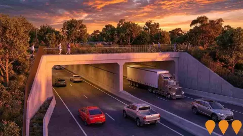
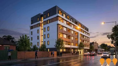
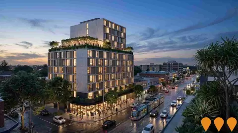
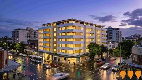
Very few factors influence local performance as much as adjustments to regional infrastructure, key projects, and planning developments. In total, AreaSearch has identified 1 project that is expected to affect the local area. Principal developments include Riviera, Ramsgate Beach, M6 Motorway Stage 1, St George Hospital Redevelopment Stage 3, and Serenity Gardens Rockdale, with the detailed list highlighting the projects that hold the greatest local significance.
Professional plan users can use the search below to filter and access additional projects.
INFRASTRUCTURE SEARCH
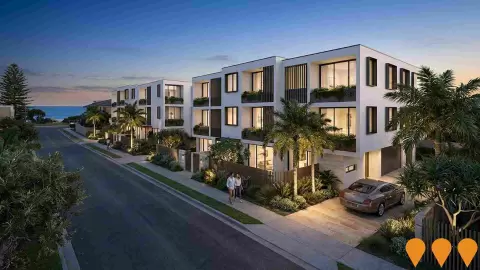
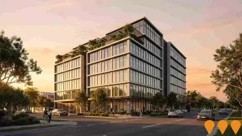
Denotes AI-based impression for illustrative purposes only, not to be taken as definitive under any circumstances. Please follow links and conduct other investigations from the project's source for actual imagery. Developers and project owners wishing us to use original imagery please Contact Us and we will do so.
Frequently Asked Questions - Infrastructure
Sydney Metro City and Southwest
A 30km metro rail extension connecting Chatswood to Bankstown via the Sydney CBD. The Chatswood to Sydenham section, featuring a new harbour crossing and seven CBD stations, opened on 19 August 2024. The final stage involves converting the 13.5km T3 Bankstown Line to metro standards between Sydenham and Bankstown, upgrading 11 stations with platform screen doors, lifts, and full accessibility. The T3 line closed in September 2024 to enable conversion works. Following delays caused by over 130 days of industrial action, the Sydenham to Bankstown section is scheduled to open in the second half of 2026. End-to-end high-speed testing at up to 100km/h commenced in November 2025, and the first full-length test run from Tallawong to Bankstown was completed in January 2026. The Bankstown Station transit interchange and community precinct opened in March 2026. When complete, the M1 Line will span 66km with 31 stations, running every four minutes in peak.
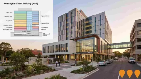
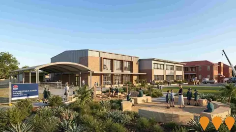
St George Hospital Redevelopment Stage 3
The $411 million St George Hospital Stage 3 redevelopment has reached a major milestone with the completion of the 9-storey Kensington Street Building (KSB) in February 2026. This centerpiece facility centralises outpatient, ambulatory, and community services, including pathology collection, day rehabilitation, and surgical services with refurbished operating theatres. It introduces new models of care such as the Rehabilitation Cognitive Transition Unit for brain injury recovery and a Behavioural Support Unit for dementia and delirium. The project also includes 151 basement car spaces, a new public forecourt, and the demolition of the Prince William Wing, with final landscaping and refurbishment of existing clinical spaces scheduled for completion by late 2026.
Community Infrastructure Strategic Plan 2050
The Community Infrastructure Strategic Plan 2050 (CISP) is a long-term framework adopted by Canterbury-Bankstown Council to guide the planning and delivery of 149 community facilities over the next 25 years. The plan focuses on consolidating ageing, fit-for-purpose assets into modern multipurpose hubs. Key initiatives include the redevelopment of the Canterbury Leisure and Aquatics Centre, new district libraries, youth centres, and enhanced cultural spaces. The strategy is designed to support a population expected to reach 500,000 by 2036, with priority growth areas identified in the Bankstown CBD and Campsie precincts.
Sydney Metro Program
Australia's largest public transport program, comprising multiple metro lines across Greater Sydney. The M1 City and Southwest line is operating to Sydenham, while the Sydenham to Bankstown conversion is in final testing with weekend closures scheduled from May to July 2026 as the project moves toward trial running and a second-half 2026 opening. Sydney Metro West is a 24 kilometre underground line between Westmead and Hunter Street targeting a 2032 opening, with confirmed stations at Westmead, Parramatta, Sydney Olympic Park, North Strathfield, Burwood North, Five Dock, The Bays, Pyrmont and Hunter Street. Sydney Metro Western Sydney Airport is under construction between St Marys, the new Western Sydney International Airport and Bradfield, with the objective of opening when the airport starts passenger services.
Low and Mid-Rise Housing Policy
Comprehensive NSW state planning reforms designed to increase housing density in well-located areas. The policy mandates mid-rise apartment buildings (3-6 storeys) and low-rise multi-dwelling housing (terraces, townhouses, and dual occupancies) within 800m of 171 high-frequency transport hubs and town centres. As of May 2026, the policy is fully operational following the phased rollout of dual occupancy provisions in July 2024 and mid-rise apartment provisions in early 2025. Recent updates include refined floor space ratios (FSR) and non-refusal standards to streamline local council assessments.
Rail Service Improvement Program - T4 Illawarra & Eastern Suburbs Line
A multi-billion-dollar upgrade (formerly More Trains, More Services) modernising the T4 line for higher frequency. Key works include the Digital Systems Program replacing trackside signals with ETCS Level 2 technology, platform extensions at Waterfall and Kiama for the Mariyung fleet, and power upgrades. As of May 2026, Mariyung trains have commenced passenger service on the South Coast Line (April 2026), and Digital Systems testing continues between Bondi Junction and Erskineville.
Mariyung Fleet (New Intercity Fleet)
The Mariyung Fleet is a 610-carriage double-deck electric train fleet (D sets) replacing the ageing V-set and Oscar fleets across the NSW intercity network. Delivered by the RailConnect NSW consortium (UGL, Hyundai Rotem, Mitsubishi Electric Australia), the trains feature wider 2x2 seating with arm rests, tray tables and cup holders, charging ports, dedicated luggage, pram and bicycle spaces, accessible toilets, dedicated wheelchair spaces, CCTV, digital information screens and Automatic Selective Door Operation. The fleet operates in 4, 6, 8 or 10-car formations. Passenger services commenced on the Central Coast & Newcastle Line on 3 December 2024, on the Blue Mountains Line on 13 October 2025, and on the South Coast Line on 14 April 2026. The South Coast Line rollout begins with seven 4 and 6-car sets, scaling to 16 trains by 2027 with 8-car sets later in 2026 and 10-car configurations in 2027. The project includes the Kangy Angy Maintenance Facility (operated by UGL on a 15-year contract) and extensive corridor upgrades including platform extensions, signalling modifications, balise installation and overhead wiring works.
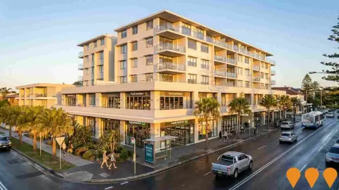
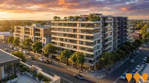
Riviera, Ramsgate Beach
Six-storey mixed-use redevelopment by Bronxx with approximately 2,926 sq m ground-floor supermarket and retail, food and drink premises at Level 1, and 44 two and three-bedroom dwellings above. DA-2023/370 was approved by the Sydney Eastern City Planning Panel on 3 Feb 2025 with a reported CIV of about $45.19m. Sales suite is operating on-site and apartments are now selling.
Employment
Employment conditions in Ramsgate Beach demonstrate strong performance, ranking among the top 35% of areas assessed nationally
Ramsgate Beach has a highly educated workforce with a significant proportion employed in professional services, an unemployment rate of only 2.8%, and an estimated job growth rate of 2.4% over the prior year, according to AreaSearch's compiled regional statistics. In March 2026982 local citizens were employed, with the unemployment rate sitting 1.4% below the 4.1% recorded for Greater Sydney, while labor force participation aligned closely with the Greater Sydney rate of 69.1%. Census records show a substantial 38.3% of citizens worked from home, though this figure may have been influenced by Covid-19 restrictions.
The primary sectors employing local citizens are transport, postal & warehousing, health care & social assistance, and professional & technical. The locality displays a distinct concentration of workers in transport, postal & warehousing, with its share of employment reaching 2.5 times the regional average. Conversely, finance & insurance is underrepresented, employing only 4.6% of the workforce in Ramsgate Beach compared to 7.3% across Greater Sydney. This heavily residential pocket seems to provide few local jobs, as shown by comparing the count of Census workers against the resident population.
According to AreaSearch analysis of SALM and ABS statistics aggregated from surrounding regions, employment rose by 2.4% over the 12-month period while the labor force grew by 2.5%, leading to a 0.1 percentage point increase in the unemployment rate. In comparison, Greater Sydney saw employment rise by 1.9%, the labor force grow by 1.9%, and unemployment drop slightly. National employment projections from May-25 by Jobs and Skills Australia provide additional context on prospective future demand in Ramsgate Beach. These five and ten-year forecasts have been aligned with the local workforce structure to project development trends. Although national employment is predicted to grow by 6.6% over five years and 13.7% over ten years, growth rates vary widely by industry. Applying these sector-specific forecasts to the employment distribution of Ramsgate Beach suggests local jobs could grow by 6.5% over five years and 13.4% over ten years (note that this is a basic weighted projection for visualization and does not account for local population forecasts).
Frequently Asked Questions - Employment
Income
The area's income profile falls below national averages based on AreaSearch analysis
The most recent postcode level ATO statistics from AreaSearch for the 2023 financial year show that incomes in the suburb of Ramsgate Beach are exceptionally high compared to the rest of the country, with a median of $55,583 and an average of $76,946. This is lower than the median of $60,817 and average of $83,003 found across Greater Sydney. Factoring in Wage Price Index growth of 10.32% since the 2023 financial year, current projections point to roughly $61,319 for the median and $84,887 for the average in March 2026. Census statistics show personal earnings at the 60th percentile ($860 per week), while household income ranks at the 34th percentile. The income distribution reveals that the largest segment, comprising 29.7% of residents (510 people), falls into the $1,500 - 2,999 range, which is very similar to the regional average of 30.9% in this bracket. Housing affordability is under substantial strain, with only 79.6% of income left over, placing the area in the 28th percentile, and the SEIFA index for income places the locality in the 5th decile.
Frequently Asked Questions - Income
Housing
Ramsgate Beach features a more urban dwelling mix with significant apartment living, with above-average rates of outright home ownership
At the most recent Census, the housing composition in Ramsgate Beach was made up of 14.7% detached houses and 85.3% other home types (semi-detached properties, apartments, and alternative dwellings), compared to the Sydney metro split of 55.9% houses and 44.1% other dwellings. The rate of outright home ownership in Ramsgate Beach was significantly higher than the Sydney metro figure at 38.4%, while the remaining homes were either mortgaged (24.7%) or occupied by tenants (36.9%). The median monthly mortgage payment of $2,184 was well below the Sydney metro average of $2,427, while the median weekly rent was recorded at $480 compared to the Sydney metro average of $470. On a national level, monthly mortgage payments in Ramsgate Beach are notably higher than the Australian average of $1,863, and rents are considerably above the national median of $375.
Frequently Asked Questions - Housing
Household Composition
Ramsgate Beach features high concentrations of lone person households, with a lower-than-average median household size
Families make up the majority of households at 59.8%, which consists of 23.6% couples with children, 23.2% couples without children, and 11.8% single parent households. Non-family living arrangements account for the remaining 40.2%, with single-person households representing 37.5% and shared households comprising 2.8% of the total. The median household size of 2.1 people is smaller than the Greater Sydney average of 2.7.
Frequently Asked Questions - Households
Local Schools & Education
The educational profile of Ramsgate Beach exceeds national averages, with above-average qualification levels and academic performance metrics
The locality presents educational disparities, with university degree completion rates (27.6% of residents) falling significantly below the SA3 regional average of 38.7%. This represents both a difficulty and a prospect for focused educational programs. Bachelor degrees are the most common at 19.1%, followed by postgraduate degrees (6.3%) and graduate diplomas (2.2%). Vocational qualifications are highly prevalent, with 34.4% of citizens aged 15+ holding technical credentials, consisting of advanced diplomas (11.1%) and certificates (23.3%).
A significant portion of the population (24.4%) is actively enrolled in formal study. This comprises 8.4% of residents in primary school, 4.6% in secondary school, and 4.1% undertaking tertiary studies.
Frequently Asked Questions - Education
Schools Detail
Nearby Services & Amenities
Transport
Transport servicing is high compared to other areas nationally based on assessment of service frequency, route connectivity and accessibility
Public transport assessment shows 19 active transit stops operating in Ramsgate Beach, which consist of bus services. These stops are served by 5 distinct routes, which combine to support 1,816 weekly passenger journeys. Transit access is classified as excellent, with residents living an average of 88 meters from their nearest stop. Since the area is primarily residential, most workers commute out of the suburb, with private cars remaining the primary choice of travel at 87% and trains used by 7%. Average car ownership is 0.9 per household, which is below the regional average. A high proportion of residents, 38.3%, work from home (based on the 2021 Census, which may show the influence of COVID-19 rules).
The average service frequency is 259 journeys per day across all routes, which translates to roughly 95 weekly trips for each transport stop.
Frequently Asked Questions - Transport
Transport Stops Detail
Health
Ramsgate Beach's residents are extremely healthy with prevalence of common health conditions low among the general population though higher than the nation's average across older, at risk cohorts
Based on AreaSearch's evaluation of mortality data and the occurrence of chronic illnesses, overall health indicators are strong throughout Ramsgate Beach. The frequency of general medical issues is low across the population, although it is higher than the national average among older, vulnerable cohorts. Additionally, the rate of private health insurance is very high, covering roughly 57% of all residents (~985 people). This compares to 59.9% across Greater Sydney.
The most frequent health conditions recorded among residents were arthritis and heart disease, affecting 9.3% and 5.8% of the population, respectively. Meanwhile, 69.2% of residents reported having no chronic medical conditions, compared to 74.6% in Greater Sydney. The locality has 27.2% of its population aged 65 and over (467 people), which exceeds the Greater Sydney benchmark of 15.5%, though this metric ranks lower on a national scale than the wider population.
Frequently Asked Questions - Health
Cultural Diversity
Ramsgate Beach was found to be more culturally diverse than the vast majority of local markets in Australia, upon assessment of a range of language and cultural background related metrics
Ramsgate Beach exhibits a high level of cultural diversity, with 36.1% of residents born outside Australia and 39.0% using a language other than English at home. The predominant religion is Christianity, accounting for 69.7% of the population in Ramsgate Beach, compared to 49.2% across Greater Sydney.
Looking at ancestral backgrounds (parents' countries of birth), the three most common heritages in Ramsgate Beach are English, representing 17.9% of the population, Other at 16.5%, and Australian at 15.5%. There are also major deviations in the concentration of other backgrounds: Greek ancestry is heavily overrepresented at 11.8% of the Ramsgate Beach population (compared to 1.9% regionally), Serbian is at 1.7% (compared to 0.5%), and Russian is at 1.4% (compared to 0.4%).
Frequently Asked Questions - Diversity
Age
Ramsgate Beach hosts a notably older demographic compared to the national average
The median age of 45 years in Ramsgate Beach is much higher than the Greater Sydney average of 37 and also considerably older than the Australian median of 38 years. Compared to Greater Sydney, Ramsgate Beach has a larger share of residents aged 75 - 84 (10.6%) but a smaller proportion of youth aged 15 - 24 (7.7%). Since the 2021 Census, the 15 to 24 age bracket has increased from 6.5% to 7.7% of the population, while the group aged 85+ rose from 3.7% to 4.8%. Meanwhile, the cohort aged 45 to 54 dropped from 13.1% to 11.3%. Projecting forward to 2041, demographic forecasts indicate notable changes in the age profile of Ramsgate Beach. The 85+ group is set to lead these changes, growing by 90% (74 people) to reach 157, up from 82. Crucially, the combined cohorts aged 65+ will represent 100% of the net population growth, highlighting the aging trend of the area. Conversely, the cohorts aged 55 to 64 and 45 to 54 will decrease in size.