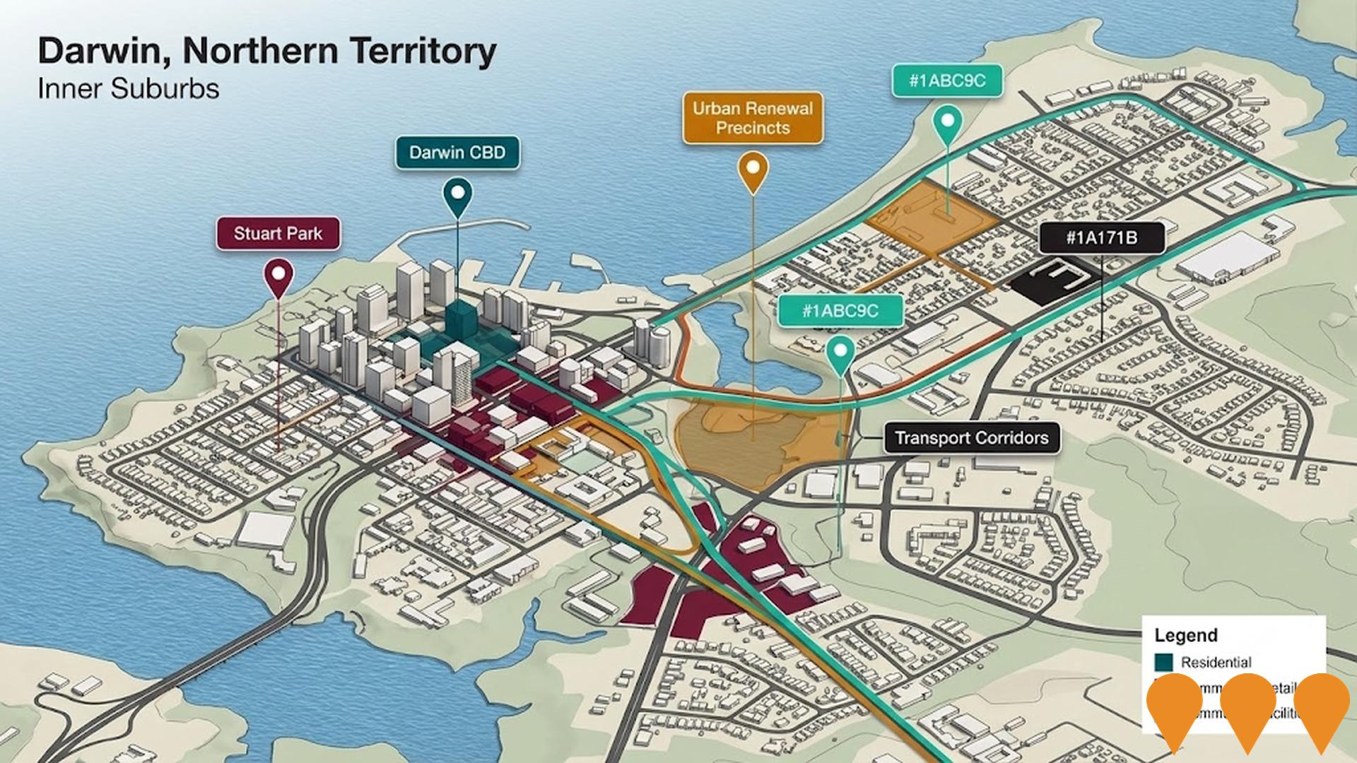
Larrakeyah

Suburb (SAL)

Greater Darwin / Darwin City


Data Sources ABSValuer GeneralRental BoardACARA Newest Sep 2026 · Refreshed ABS QuickStats SAL70159 How we calculate this
Chart Color Schemes
Loading map data ...
Suburb (SAL) Boundary Analysis

This analysis uses Suburbs and Localities (SAL) boundaries, which can materially differ from Statistical Areas (SA2) even when sharing the same name.

SAL boundaries are defined by Australia Post and the Australian Bureau of Statistics to represent commonly-known suburb names used in postal addresses.

Statistical Areas (SA2) are designed for census data collection and may combine multiple suburbs or use different geographic boundaries. For comprehensive analysis, consider reviewing both boundary types if available.

0 People

est. as @ -- *

2021 Census | -- people

Land Area
--
Land Area
Population Density
--
Density
Unemployment Rate
--
Unemployment
Development
--
Resi Approvals
Get My Report

Sales ActivityProperty Sales Trends in Larrakeyah

Table Chart PROFILE FAQ

Curious about local property values? Filter the chart to assess the volume and appreciation (including resales) trends and regional comparisons, or scroll to the map below view this information at an individual property level.

Find a Recent Sale
Type Specified (1) | Limit 50

Sales Detail

DemographicsPopulation Growth in Larrakeyah

Table Chart PROFILE FAQ

Larrakeyah has an estimated 4,731 residents, up from 3,943 at the 2021 Census — a change of 788 people, or 20.0%. Growth has averaged 2.8% a year over five years, faster than 90% of areas nationally. Overseas migration accounts for 82.0% of that increase. That puts 2,426 residents on each square kilometre. Population is estimated from ABS Estimated Resident Population releases and GNAF address data, re-based from the 2021 Census and updated annually.

Detail

According to AreaSearch's evaluation of broader ABS population updates and post-Census address validations, the suburb of Larrakeyah has an estimated population of around 4,731 as of Aug 2026. This indicates an expansion of 788 people (20.0%) compared to the 2021 Census tally of 3,943 people. The figure is derived from the 4,731 resident count calculated following the ABS ERP release in June 2025 alongside subsequent address verification. With 2,426 persons per square kilometer, the locality's population density sits in the top quartile of nationally assessed regions. Outperforming both the territory and the 9.5% national benchmark, the suburb of Larrakeyah stands out as a regional growth leader, driven predominantly by overseas migration which supplied approximately 82.0% of recent population gains.

Population modeling by AreaSearch incorporates 2024 ABS/Geoscience Australia SA2 figures using 2022 as a base, supplemented by ABS 2023 Greater Capital Region age-cohort projections (built on 2022 data) for other zones and post-2032 horizons. Looking ahead, the suburb of Larrakeyah is positioned for above-median national expansion, with aggregated SA2 figures projecting a 16-year addition of 656 persons (a 13.9% total rise) through to 2041.

Frequently Asked Questions - Population

What is the latest population estimate for the suburb of Larrakeyah?
Total population for the suburb of Larrakeyah was estimated to be approximately 4,731 as at Aug 26. This is based upon an estimated resident population of 4,731 from the ABS up to June 2025.
How has the population in the suburb of Larrakeyah changed since 2021?
The suburb of larrakeyah has added approximately 788 people and shown a 19.98% increase from the 3,943 people recorded at the 2021 Census period.
What is the population density in the suburb of Larrakeyah?
The population density in the suburb of Larrakeyah is estimated at 2,426 persons per square kilometer based on the latest population estimate.
How much has the population grown over the past 10 years in the suburb of Larrakeyah?
Over the past 10 years, the population in the suburb of Larrakeyah has shown a compound annual growth rate of 1.8% per annum.
What are the main drivers of population growth in the suburb of Larrakeyah?
Population growth in the suburb of Larrakeyah is driven by: Overseas migration (82.0%), Natural increase (18.0%), Interstate migration (0.0%). The primary driver is Overseas migration, contributing 82.0% of overall population gains.

Residential SupplyHousing Development & Building Approvals in Larrakeyah

Table Chart PROFILE FAQ

Detail

Analysis of ABS building approvals by AreaSearch shows that Larrakeyah averages around 2 new home approvals annually, accumulating an estimated 13 dwellings across the last 5 financial years. Throughout FY-25 to date, no approvals have been registered. Between FY-21 and FY-25, an average of 67.9 incoming residents arrived for each newly constructed home, creating a notable supply deficit that typically drives price appreciation and heightened competition. Meanwhile, commercial construction activity totaled $51,000 this financial year, underscoring the predominantly residential landscape. Per capita residential construction in Larrakeyah reaches roughly 59% of Greater Darwin levels and ranks in the 9th percentile across the nation, constraining housing options and channeling demand toward established properties.

This subdued pipeline reflects the established urban footprint and local planning constraints. Current building activity is divided evenly between detached houses (50.0%) and townhouses or apartments (50.0%), offering accessible price points for first-home buyers, investors, and downsizers. Notably, house construction outpaces the 22.0% freestanding dwelling share recorded at Census, highlighting persistent appetite for detached housing in an area where approvals average approximately 2280 people per dwelling. The latest AreaSearch quarterly projections anticipate a gain of 656 residents in Larrakeyah through to 2041. If building volume remains at current levels, new residential supply will fall behind demographic expansion, likely intensifying market competition and supporting ongoing value growth.

Frequently Asked Questions - Development

How many dwelling approvals have occurred in the suburb of Larrakeyah recently?
Dwelling approval activity in the the suburb of Larrakeyah area has seen 4 residential approvals over the past two financial years, based on AreaSearch's SA2 aggregation method. The suburb of Larrakeyah's current population of 4,731 has been supported by 2 approvals on average over recent years.
How does the suburb of Larrakeyah's development activity compare to the broader region?
The suburb of Larrakeyah has seen 0.04 approvals per 100 people in recent years, compared to 0.25 approvals in the broader region. This means that one dwelling has been approved for every 2280 people in the suburb of Larrakeyah, compared to one for every 339 in the broader region.
Is the suburb of Larrakeyah keeping up with housing demand?
With the population expected to increase by 656 people by 2041, around 328 new dwellings will be necessary. Recent approval levels may be insufficient to meet these forecasts, considering the census average of 2.0 persons per dwelling. This indicates potential housing shortages if current approval trends continue.
What has been the trend in development approvals over the past five years in the suburb of Larrakeyah?
Looking at development activity over the past five years, the suburb of Larrakeyah's approval levels have been significantly below the yearly average of 2, showing a notable downturn in recent development.
How many dwellings will be needed to accommodate future population growth in the suburb of Larrakeyah?
The population in the suburb of Larrakeyah is expected to grow by 656 people by 2041, necessitating approximately 328 new dwellings. This calculation is based on the current census average of 2.0 persons per dwelling in the area.
How does recent development compare to population growth in the suburb of Larrakeyah?
Over the past five years, the population in the suburb of Larrakeyah has grown by approximately 1,450 people, while 13 residential approvals were recorded. This equates to a ratio of 111.5 people added for each new dwelling approval. This high ratio suggests strong population growth relative to housing supply, potentially indicating unmet housing demand.
Are there opportunities for residential developers in the suburb of Larrakeyah?
With dwelling approval activity running at an average of 2 approvals per year and a population of 4,731, there appears to be a supply shortfall relative to projected demand, presenting strong opportunities for residential developers. With the population expected to increase by 656 people by 2041, around 328 new dwellings will be necessary. Current approval trends may be insufficient to meet forecast demand, indicating strong development opportunities.
Approvals Pipeline Development applications near Larrakeyah

Development applications around Larrakeyah

Development approvals is a new addition to AreaSearch. We’re actively expanding council coverage and refining the dataset — details and statuses for some councils may be partial. Check back regularly for the latest pipeline.
Applications
In this area
Est. Value
Where disclosed
Under Assessment
Awaiting determination
Determined
Approved or decided
Approvals pipeline Status, location, timing and project scale
Search

Loading development applications…

Lodged Address Description Type Distance Status

SOURCE: Planning portals and council registers, compiled by AreaSearch. Distance & bearing measured from the suburb midpoint.

Project PipelineInfrastructure & Major Projects in Larrakeyah

PROFILE FAQ

AreaSearch tracks 5 current infrastructure and development projects inside Larrakeyah, worth an estimated $637 million. A further 31 sit in the immediately surrounding suburbs, taking the tracked pipeline within reach of the area to $4.38 billion. 13 are already under construction and 13 are due for completion within three years. The pipeline spans residential development, communities and sports & recreation. Records are compiled from Infrastructure Australia, state agencies, council planning portals and public announcements, reviewed and updated daily, then ranked by proximity, construction stage, completion horizon and project scale.

Detail

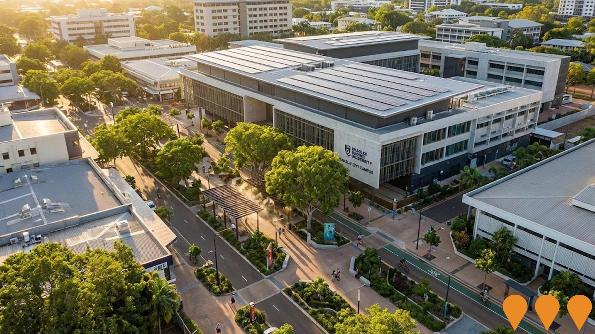
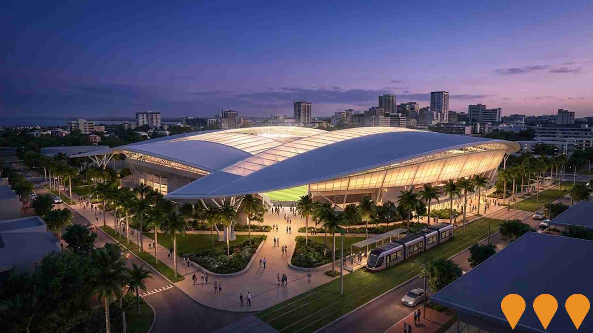
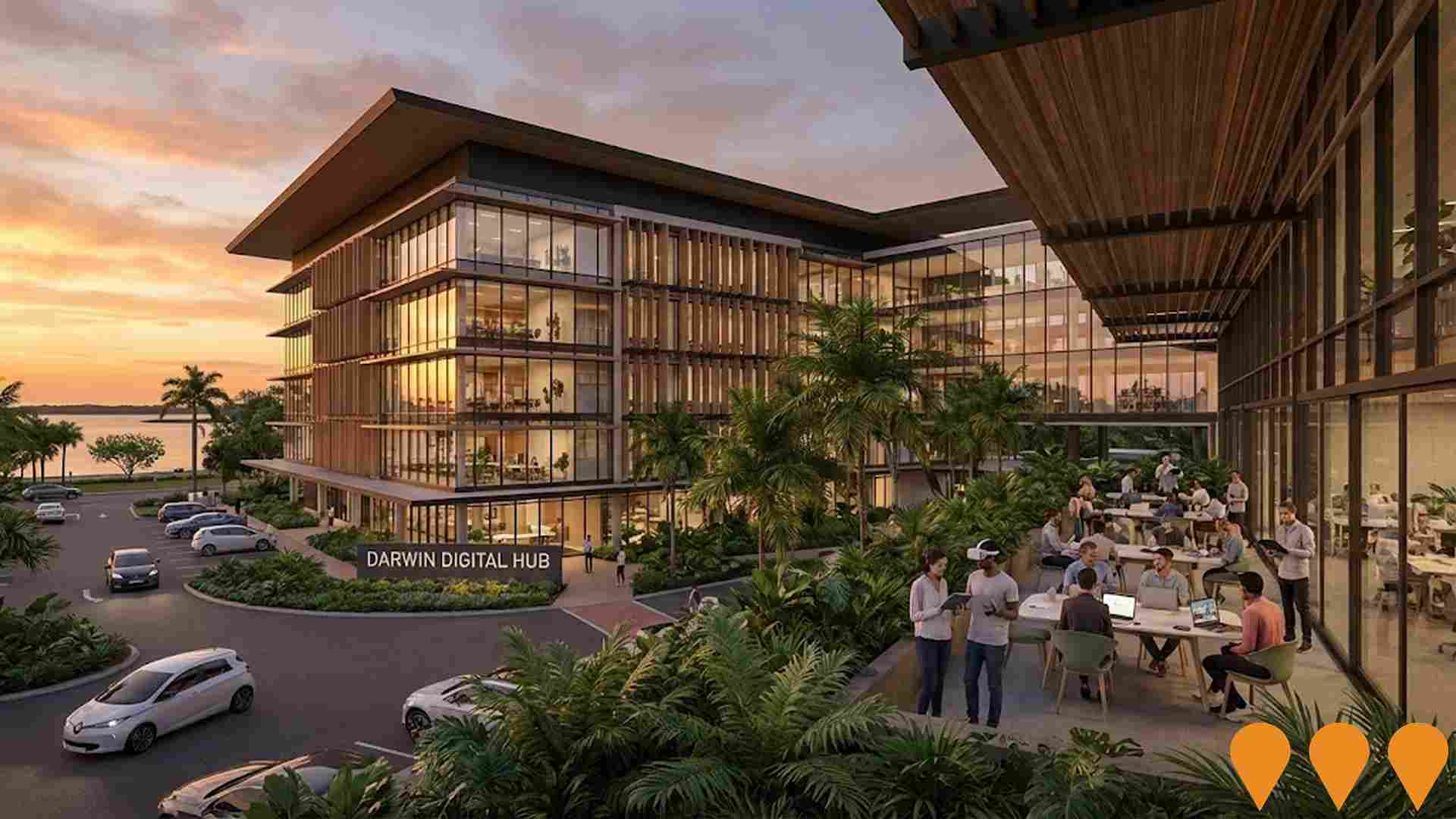
Infrastructure investments, major developments, and strategic urban plans are critical drivers of local performance. AreaSearch has pinpointed 14 influential initiatives across the area, including high-profile undertakings such as Darwin Galleria (Former Coles Site Redevelopment), Larrakeyah Defence Precinct Redevelopment, The Avenue Larrakeyah, and Darwin Digital Hub.

Professional plan users can use the search below to filter and access additional projects.

INFRASTRUCTURE SEARCH

All Selected

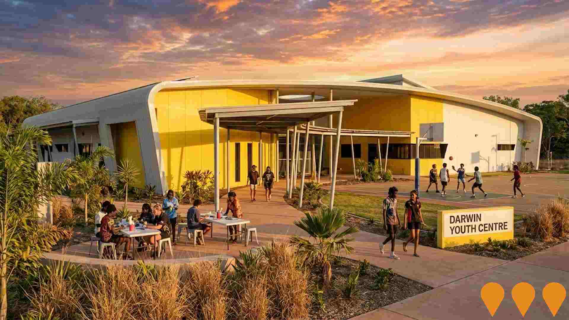
AI Generated Denotes AI-based impression for illustrative purposes only, not to be taken as definitive under any circumstances. Please follow links and conduct other investigations from the project's source for actual imagery. Developers and project owners wishing us to use original imagery please Contact Us and we will do so.

Frequently Asked Questions - Infrastructure

What are some of the major infrastructure and planning changes likely to influence the suburb of Larrakeyah?
Key infrastructure and planning changes likely to influence the suburb of Larrakeyah include: Darwin Galleria (Former Coles Site Redevelopment) (Construction); Larrakeyah Defence Precinct Redevelopment (Construction); The Avenue Larrakeyah (Construction); Darwin Digital Hub (Construction); and Darwin Youth Centre (Construction). These projects represent significant developments that will shape the area's future infrastructure landscape.
What types of infrastructure projects are impacting the suburb of Larrakeyah?
Infrastructure development impacting the suburb of Larrakeyah spans multiple sectors including Residential Development, Sports & Recreation, and Communities, Precincts & Urban Renewal, among others.
What is the scale of infrastructure investment impacting the suburb of Larrakeyah?
Infrastructure investment analysis indicates substantial capital deployment exceeding $1.3 billion in projects that will impact the extended area, with a notable concentration of investment within the immediate the suburb of Larrakeyah vicinity.
How does the suburb of Larrakeyah's infrastructure development compare to other areas?
Infrastructure development activity impacting the suburb of Larrakeyah currently ranks below national averages at the 30thth percentile.
The Avenue Larrakeyah
Category: Residential Development
Stage: Construction | Est. Comp: 2026

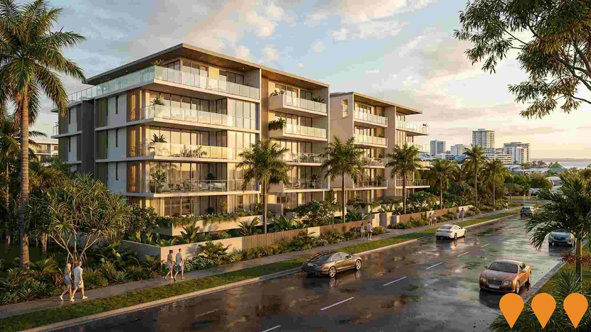
Luxury residential apartment development comprising 54 premium one, two and three bedroom apartments with rooftop resident amenities in Larrakeyah, close to the Darwin CBD. Publicly available information indicates the project remains under construction, with apartment sales continuing.

Residential Development

Asti Motel Redevelopment, Packard Place
Category: Residential Development
Stage: Under Assessment | Est. Comp: 2029
Source / Links: Link 1   Link 2  

Redevelopment of the former Asti Motel site into two residential towers of 10 and 11 storeys comprising 119 apartments, including 56 residential dwellings and 63 serviced apartments. The proposal includes approximately 1,700 sqm of communal landscaped open space, a gymnasium, swimming pool and three basement parking levels. The latest application supersedes earlier approved schemes with a revised two-building design.

Residential Development

Darwin Galleria (Former Coles Site Redevelopment)
Category: Retail
Stage: Construction | Est. Comp: 2028
Source / Links: Link 1   Link 2  

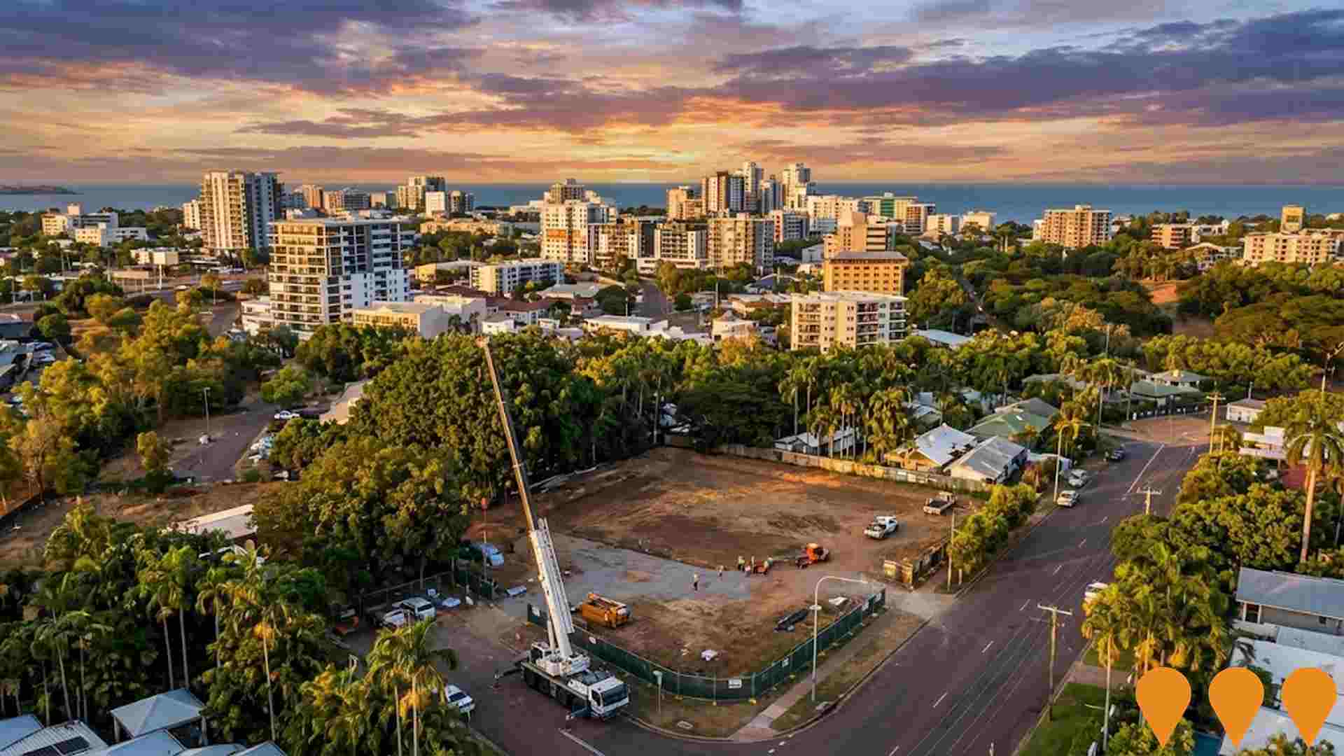
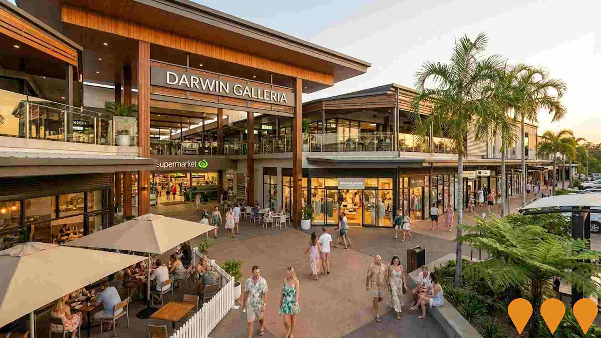
A major revitalisation of the former Coles site into a premium mixed-use precinct in the Darwin CBD. The project includes a multi-level retail podium with a flagship supermarket, specialty retail tenancies, and alfresco dining spaces. The redevelopment aims to integrate seamlessly with the Smith Street Mall improvements while providing modern office space and potential hospitality facilities in the upper levels to drive city center foot traffic.
Retail

Mantra on the Esplanade Hotel Refurbishment & Apartment Addition
Category: Residential Development
Stage: Construction | Est. Comp: 2026
Source / Links: Link 1   Link 2  

A major refurbishment and adaptive reuse project at the 88 The Esplanade site, involving the conversion of hotel rooms into private residential apartments and the refurbishment of remaining guest suites. The project includes upgrades to the penthouse suites and common areas, with active renovation works scheduled between November 2025 and April 2026.

Residential Development

Larrakia Cultural Centre
Category: Arts & Culture
Stage: Construction | Est. Comp: 2026
Source / Links: Link 1   Link 2  

Major Indigenous cultural centre on the Darwin Waterfront celebrating Larrakia Country, language, culture and knowledge. The project includes exhibition galleries, performance and education spaces, retail, cultural experiences and landscaped public areas. Construction commenced in May 2024 following a ground turning ceremony, with Sunbuild appointed as the main contractor.

Arts & Culture

Civic and State Square Precinct Revitalisation
Category: Communities, Precincts & Urban Renewal
Stage: Construction | Est. Comp: 2026
Source / Links: Link 1   Link 2  

Revitalisation of the Civic and State Square Precinct in Darwin CBD to deliver shady parklands, public art, and connections across Parliament House, Supreme Court, and Government House. Completed milestones include the 450-bay underground car park, native gardens, Chan Lawns, and the Liberty Square redevelopment. Construction of the cornerstone 3-storey State Square Building (formerly intended as the NT Art Gallery) is tracking towards structural completion in mid-2026, with the Northern Territory Government executing an Expressions of Interest (EOI) process to determine its final activation and use.

Communities, Precincts & Urban Renewal

Northern Territory Art Gallery
Category: Arts & Culture
Stage: Construction | Est. Comp: 2026
Source / Links: Link 1   Link 2  

The Northern Territory Art Gallery, formally the State Square Building, is a 145 million dollar cultural facility under construction in Darwin's State Square precinct in the CBD, adjacent to Parliament House and the Supreme Court, as part of the Darwin City Deal jointly funded by the Northern Territory and Australian Governments. Designed by Ashford Architects with Clare Design and Hully Liveris, and built by local contractor Sitzler Pty Ltd, the three storey building with a basement level features a ground level foyer, two large gallery display spaces, offices, a courtyard, and space for a retail shop and cafe, with a first floor verandah facing Smith Street.Construction is anticipated to be completed in Q3 2026. Following a cost blowout of more than 100 million dollars above original estimates, the Northern Territory Government has opened the building's future use and operation to a public Expression of Interest process, so its final function as an art gallery is not yet confirmed.

Arts & Culture

Larrakeyah Defence Precinct Redevelopment
Category: National Security
Stage: Completed | Est. Comp: 2024
Source / Links: Link 1   Link 2  

The Larrakeyah Defence Precinct Redevelopment Program upgraded Larrakeyah Barracks and HMAS Coonawarra in Darwin at a cost of around 600 million AUD. The program comprised two components: the Larrakeyah Barracks Redevelopment, which renewed power, water, stormwater, sewerage and ICT services and delivered a new Base Entry Precinct and NORFORCE facilities, and the Facilities to Support Naval Operations in the North, which delivered the new 250m Kuru Wharf, a hardstand with support buildings, and a ready-use fuel storage facility with 3.5ML capacity.Kuru Wharf was officially opened in July 2024, providing berthing for major surface combatants and submarines, and the broader program has now been completed.

National Security

Jobs & IndustryEmployment Trends in Larrakeyah

Table Chart PROFILE FAQ

3,155 residents of Larrakeyah are employed, from a labour force of 3,174. Unemployment sits at 0.6%, with participation at 78.1%. Weighted for its industry mix, the area's sectors are forecast to grow about 6.3% nationally over five years. That reflects industry composition only and makes no allowance for local population growth, so in an area growing as fast as this one it understates the likely rise in local jobs. The working-day population is estimated at 4,086, about 86% of the resident population, so more people leave the area for work than travel in. Unemployment and labour force come from ABS Small Area Labour Markets, updated quarterly; the industry and occupation profile is from the 2021 Census.

Detail

Larrakeyah features an exceptionally qualified labour pool anchored by key essential services, recording an unemployment rate of only 0.6% alongside 1.1% estimated yearly job growth, according to aggregated statistical data from AreaSearch. Employed residents totaled 3,155 as of March 2026, with local unemployment sitting 2.9% under the 3.5% Greater Darwin benchmark and workforce participation reaching 78.1% compared to 72.9% across Greater Darwin. Working from home was recorded by a modest 5.6% of workers at the Census, a figure influenced by Covid-19 restrictions. Local workers are concentrated primarily in public administration & safety, accommodation & food, and health care & social assistance.

Public administration & safety represents a notable strength, employing residents at 1.4 times the regional level. Conversely, construction accounts for just 5.1% of employment compared to 9.2% across the wider region. Census figures comparing local jobs to resident workers confirm that the neighbourhood functions predominantly as a residential base with few internal employment hubs. AreaSearch analysis of ABS and SALM figures indicates that over the 12 months to March 2026, a 1.1% lift in employment against a 0.9% labour force expansion lowered local unemployment by 0.2 percentage points. Over the same timeframe, Greater Darwin saw employment grow by 0.4%, the labour force rise by 0.8%, and unemployment increase by 0.3 percentage points. Applying Jobs and Skills Australia Mar-26 national industry growth targets (6.6% over five years and 13.7% over ten years) to the local profile suggests potential employment gains of 6.3% over five years and 13.2% over ten years, representing a simple weighted illustration without localised population adjustments.

Frequently Asked Questions - Employment

What is the employment situation in the suburb of Larrakeyah?
As of March 2026, the suburb of Larrakeyah has approximately 3,155 employed residents with an unemployment rate of 0.6%. This very low unemployment rate indicates a tight labour market with strong demand for workers. The area ranks in the top 25% nationally for employment performance, indicating a robust job market.
How does the suburb of Larrakeyah's unemployment rate compare to the broader region?
As of March 2026, the unemployment rate in the suburb of Larrakeyah stands at 0.6%, which is 2.9 percentage points below Greater Darwin's rate of 3.5%. This lower unemployment rate suggests stronger local employment conditions. For comparison, the national unemployment rate is 4.2%.
What are the major employment sectors in the suburb of Larrakeyah?
The employment landscape in the suburb of Larrakeyah is dominated by several key sectors. The largest employers are public administration & safety (26.9% of employment), accommodation & food (13.0%), and health care & social assistance (13.0%). These three sectors alone account for 52.9% of local employment, indicating significant concentration. Other significant employers include professional & technical and retail trade.
How has employment changed recently in the suburb of Larrakeyah?
Over the past year to March 2026, the suburb of Larrakeyah has experienced employment growth, with total employment increasing while the labour force increased. As a result, the unemployment rate has fall. By comparison, Greater Darwin saw employment increased and its unemployment rate rose.
What is the workforce participation rate in the suburb of Larrakeyah?
The workforce participation rate in the suburb of Larrakeyah is 78.1%, which represents the proportion of working-age residents who are either employed or actively seeking work. This high participation rate indicates strong workforce engagement and economic vitality. The local rate leading the Greater Darwin average of 72.9%, indicating stronger workforce attachment in the local area.
Which industries are over-represented in the suburb of Larrakeyah's employment market?
The suburb of larrakeyah shows notable specialization in public administration & safety, which employs 26.9% of the local workforce compared to 19.5% regionally. This moderate specialization indicates some local strength in the sector. The area also shows above-average employment in 1 other sectors, contributing to a distinctive economic profile.
What are the employment growth prospects for the suburb of Larrakeyah?
Based on Jobs and Skills Australia projections applied to the suburb of Larrakeyah's industry mix, employment is expected to grow by 6.3% over the next five years and 13.2% over ten years. This compares to national growth expectations of 6.6% over five years. Steady growth is anticipated across multiple sectors, providing diverse employment opportunities.
How does the job market in the suburb of Larrakeyah compare nationally?
The suburb of larrakeyah's employment market shows strong performance nationally, ranking in the top 25% of areas assessed by AreaSearch. This indicates robust employment conditions and economic vitality compared to other regions. Recent job advertisement trends show the broader employment region saw a 14.2% decline, ranking 36.0th out of 37 regions nationally.
What employment opportunities exist for skilled workers in the suburb of Larrakeyah?
Skilled workers will find good opportunities in the suburb of Larrakeyah, with skilled sectors accounting for 28.4% of employment. Key sectors for skilled workers include health care & social assistance (13.0%), professional & technical (7.2%), and education & training (5.7%). With projected employment growth of 6.3% over five years, demand for skilled workers is expected to remain strong.

EarningsHousehold Income in Larrakeyah

Table Chart PROFILE FAQ

Median household income in Larrakeyah is $2,372 a week (about $123,000 a year), with median personal income at $1,297 a week. ATO records put median taxable income at $71,643 a year against an average of $88,443. Household income is from the 2021 Census; taxable income is from ATO Taxation Statistics for the latest financial year available, indexed forward using the ABS Wage Price Index.

Detail

ATO postcode figures compiled by AreaSearch for financial year 2023 place personal income in the suburb of Larrakeyah among the highest nationally, featuring a median of $71,643 and an average of $88,443, outperforming Greater Darwin medians of $66,956 and averages of $77,199. Factoring in 9.41% Wage Price Index expansion since financial year 2023, updated figures as of March 2026 are estimated at approximately $78,385 (median) and $96,765 (average). In the 2021 Census, local personal, family, and household earnings placed between the 86th and 94th percentiles across Australia. The primary earnings group encompasses 41.1% of residents (1,944 people) earning $1,500 - 2,999 weekly, aligning with the regional proportion of 36.7%.

Furthermore, 36.9% generate weekly earnings above $3,000, underscoring strong local buying capacity. Housing accounts for 14.2% of income, positioning residents in the 87th percentile for disposable income and placing the suburb in the 8th decile for SEIFA income.

Frequently Asked Questions - Income

What is the median taxable income in the suburb of Larrakeyah?
Based on Wage Price Index adjustments to March 2026, the estimated median taxable income in the suburb of Larrakeyah is approximately $78,385. The official ATO data from FY-23 recorded a median of $71,643.
What is the average taxable income in the suburb of Larrakeyah?
Based on Wage Price Index adjustments to March 2026, the estimated average taxable income in the suburb of Larrakeyah is approximately $96,765. The official ATO data from FY-23 recorded an average of $88,443.
How does the median taxable income in the suburb of Larrakeyah compare to the region?
Based on Wage Price Index adjustments to March 2026, the estimated median taxable income in the suburb of Larrakeyah is approximately $78,385 compared to $73,257 in Greater Darwin. The official ATO data from FY-23 shows $71,643 and $66,956 respectively.
How does the average taxable income in the suburb of Larrakeyah compare to the region?
Based on Wage Price Index adjustments to March 2026, the estimated average taxable income in the suburb of Larrakeyah is approximately $96,765 compared to $84,463 in Greater Darwin. The official ATO data from FY-23 shows $88,443 and $77,199 respectively.
What are the main income cohorts in the suburb of Larrakeyah according to the 2021 Census?
As per the 2021 Census, the income bracket containing the largest proportion (~41.1% / 1,944 persons) of the suburb of Larrakeyah's population is the $1,500 - 2,999 cohort.
How do the main income cohorts in the suburb of Larrakeyah compare to the region?
The largest income cohort in the suburb of Larrakeyah is the $1,500 - 2,999 group, representing about 41.1% of the population. In comparison, Greater Darwin's largest income cohort is the $1,500 - 2,999 group, representing 36.7% of its population, according to the 2021 Census.
What is the median household income in the suburb of Larrakeyah according to the 2021 Census?
The 2021 Census data indicates that the median household income in the suburb of Larrakeyah is $2,372/wk.
What is the median family income in the suburb of Larrakeyah according to the 2021 Census?
According to the 2021 Census, the median family income in the suburb of Larrakeyah is $2,695/wk.
What is the median personal income in the suburb of Larrakeyah according to the 2021 Census?
The 2021 Census shows that the median personal income in the suburb of Larrakeyah is $1,297/wk.
How does the suburb of Larrakeyah's income rank nationally?
As per AreaSearch's latest postcode level ATO data released for FY-23, the suburb of Larrakeyah's median income among taxpayers is $71,643, with an average of $88,443. This is extremely high nationally, and compares to Greater Darwin's median of $66,956 and average of $77,199. Based on Wage Price Index growth of 9.41% since FY-23, current estimates would be approximately $78,385 (median) and $96,765 (average) as of March 2026.
What is the disposable income in the suburb of Larrakeyah?
The estimated disposable income in the suburb of Larrakeyah is $8,822 per year according to AreaSearch analysis.
How does the suburb of Larrakeyah's disposable income compare to the region?
The suburb of larrakeyah's disposable income is $8,822 compared to $8,044 for Greater Darwin, based on AreaSearch analysis.

Housing StockHousing & Dwellings in Larrakeyah

Table Chart PROFILE FAQ

Larrakeyah had 1,439 occupied dwellings at the 2021 Census, 22% detached houses and 66% apartments. 17% are owned with a mortgage, 67% rented and 16% owned outright. At that Census the median rent was $395 a week and the median mortgage repayment $1,800 a month, a total housing cost higher than 78% of areas nationally. Rent absorbs 16.7% of household income here and mortgage repayments 17.5%. Dwelling stock, tenure and housing costs are 2021 Census measures — the only source that counts dwellings at this boundary size.

Detail

The residential stock in Larrakeyah at the last Census was composed of 22.0% separate houses and 78.0% alternative formats such as semi-detached homes, apartments, and other dwellings, in contrast to the Darwin metro distribution of 63.5% houses and 36.5% other dwellings. Outright home ownership stood at 15.9%, trailing Darwin metro, with the balance comprised of mortgaged properties (17.1%) and rental accommodation (67.1%). Typical monthly mortgage commitments of $1,800 were lower than Darwin metro's $2,100, while median weekly rent reached $395 compared to $385 across Darwin metro. Across the country, local mortgage costs sit below the Australian average of $1,863, whereas weekly rents exceed the national benchmark of $375.

Frequently Asked Questions - Housing

What percentage of homes are owned vs rented in the suburb of Larrakeyah?
In the suburb of Larrakeyah, 15.9% of homes are owned outright, 17.1% are owned with a mortgage, and 67.1% are rented.
What percentage of dwellings in the suburb of Larrakeyah are houses?
According to the latest data, 22.0% of dwellings in the suburb of Larrakeyah are houses.
What percentage of dwellings in the suburb of Larrakeyah are apartments or units?
In the suburb of Larrakeyah, 66.3% of dwellings are apartments or units, with an additional 11.5% being semi-detached dwellings.
What is the level of outright home ownership in the suburb of Larrakeyah?
Outright home ownership in the suburb of Larrakeyah stands at 15.9%, compared to 17.9% in Greater Darwin.
What is the median monthly mortgage repayment in the suburb of Larrakeyah?
The median monthly mortgage repayment in the suburb of Larrakeyah is $1,800, compared to $2,100 in Greater Darwin.
What is the median weekly rent in the suburb of Larrakeyah?
The median weekly rent in the suburb of Larrakeyah is $395, compared to $385 in Greater Darwin.
What is the distribution of rental prices in the suburb of Larrakeyah?
In the suburb of Larrakeyah, 5.1% of rentals are $0-149/week, 27.2% are $150-349/week, 59.0% are $350-649/week, 7.0% are $650-949/week, and 1.6% are $950+/week.
What is the average monthly housing cost in the suburb of Larrakeyah?
The aggregate monthly housing cost in the suburb of Larrakeyah is $1,456, which represents the average monthly cost across all housing types.
What percentage of income do residents spend on housing in the suburb of Larrakeyah?
In the suburb of Larrakeyah, households with mortgages typically spend 17.5% of their income on mortgage repayments, while renters spend 16.7% of their income on rent.
How crowded are homes in the suburb of Larrakeyah?
The average persons per bedroom ratio in the suburb of Larrakeyah is 0.9, indicating the level of household density.
How does housing affordability in the suburb of Larrakeyah compare to the region?
Housing affordability in the suburb of Larrakeyah shows mortgage holders spending 17.5% of income on repayments (vs 21.9% regionally), while renters spend 16.7% of income on rent (vs 17.4% regionally).
What types of dwellings are most common in the suburb of Larrakeyah?
The dwelling mix in the suburb of Larrakeyah consists of 22.0% detached houses, 11.5% semi-detached dwellings, 66.3% apartments, and 0.2% other dwelling types.
What is the weighted average housing cost based on tenure mix in the suburb of Larrakeyah?
Accounting for the local ownership mix, the weighted average monthly housing cost is approximately $1,455. This accounts for outright owners paying no housing costs, mortgage holders paying $1,800/month, and renters paying $1,710/month.
How affordable is housing in the suburb of Larrakeyah relative to local incomes?
Housing in Larrakeyah consumes approximately 14.2% of median household income ($10,271 monthly), indicating costs are highly affordable. The generally accepted benchmark is that housing should not exceed 30% of household income.
How do proposed developments compare to existing housing types in the suburb of Larrakeyah?
Development activity remains minimal in this area with fewer than 5 recent applications recorded.

HouseholdsHousehold Composition in Larrakeyah

Table Chart PROFILE FAQ

Larrakeyah counted 1,439 households at the 2021 Census, an estimated 1,727 today, averaging 2.3 people each. 25% are couples with children, against 32% couples without children. 28% of households are people living alone, and families average 1.0 children. Household and family composition is measured only by the Census, so these are 2021 figures.

Detail

Families constitute 61.4% of local households, consisting of couples without children (31.8%), couples with children (24.8%), and single parent families (4.2%). Non-family living arrangements account for the remaining 38.6%, split between single-person homes (28.4%) and group households (10.1%). The typical household comprises 2.3 people, tracking below the Greater Darwin average of 2.6.

Frequently Asked Questions - Households

How many households are in the suburb of Larrakeyah?
As of the 2021 Census, the suburb of Larrakeyah had 1,439 households. Based on population growth patterns, this has grown by approximately 20.0% to an estimated 1,727 households today.
What is the typical household size?
The median household size in the suburb of Larrakeyah is 2.3 people. This compares to 2.6 in Greater Darwin and reflects the area's household composition mix.
What types of households are most common?
Family households dominate at 61.4% of all households. The remaining households consist of lone person households (28.4%), group households (10.1%), and other household types (0.0%).
How are families structured in the area?
Among the 883 family households, 24.8% are couples with children, 31.8% are couples without children at home, and 4.2% are single parent families. This mix shapes local demand for schools, family services, and housing types.
How does the suburb of Larrakeyah compare to regional household patterns?
Compared to Greater Darwin, the suburb of Larrakeyah shows distinct household patterns. Conversely, family households are under-represented at 61.4% compared to the regional 71.0%. This higher proportion of single-person households drives demand for smaller dwellings and different community services.
What is the average family size?
Families in the suburb of Larrakeyah have an average of 1.0 children, slightly below the Greater Darwin average of 1.4. This influences local demand for child-related services and larger family homes.
What are the marriage patterns in the suburb of Larrakeyah?
Marriage patterns reveal 42.5% of the adult population are currently married, while 45.2% have never married. This compares to 42.3% married and 43.1% never married across Greater Darwin.
How significant are single-person households?
Single-person households represent 28.4% of all households in the suburb of Larrakeyah, similar to the regional average of 23.4%. This affects demand for smaller dwellings and single-person accommodation.
Are shared living arrangements common?
Group households (unrelated people sharing) account for 10.1% of households, well below the Greater Darwin average of 5.6%. This low rate suggests limited student or young professional shared accommodation.
Loading household composition data...

EducationSchools & Education in Larrakeyah

Table Chart PROFILE FAQ

48.9% of adults in Larrakeyah hold a university qualification, including 29.7% with a bachelor degree and 14.6% with postgraduate qualifications, higher than 95% of areas nationally. A further 16.8% hold a vocational qualification. 1 school serves the area, with 465 enrolment places and an average ICSEA of 1,083 against a national benchmark of 1,000. Qualifications come from the 2021 Census; school enrolments, ICSEA and results come from ACARA's current release.

Detail

Higher education rates in Larrakeyah outpace broader figures, with 48.9% of inhabitants aged 15+ holding tertiary degrees compared to 27.3% across NT and 30.4% across Australia, creating a solid base for professional roles. Bachelor degrees are held by 29.7% of residents, followed by 14.6% with postgraduate credentials and 4.6% holding graduate diplomas. Technical and vocational qualifications are held by 28.5% of residents aged 15+, divided between certificates (16.8%) and advanced diplomas (11.7%). Formal study engagement is substantial, with 32.3% of the community actively undertaking education. This cohort includes 9.4% in primary school, 9.3% in tertiary programs, and 4.1% enrolled in secondary schooling.

Frequently Asked Questions - Education

What percentage of people in the suburb of Larrakeyah have university qualifications?
48.9% of people aged 15 and over in the suburb of Larrakeyah have university qualifications, compared to 31.3% in the broader region.
What percentage of people in the suburb of Larrakeyah have no formal qualifications?
22.7% of people aged 15 and over in the suburb of Larrakeyah have no formal qualifications, compared to 32.6% regionally.
How does the suburb of Larrakeyah's education level compare to national averages?
The suburb of larrakeyah ranks in the 95th percentile nationally for education based on AreaSearch's analysis of qualification and performance metrics.
What types of qualifications are most common in the suburb of Larrakeyah?
The most common qualifications in the suburb of Larrakeyah are: Bachelor Degree (29.7%), Certificate (16.8%), Postgraduate (14.6%).
What proportion of the suburb of Larrakeyah's population is currently attending educational institutions?
32.3% of the population in the suburb of Larrakeyah is currently engaged in formal education, with 9.4% in primary school, 4.1% in secondary school, 9.3% at university.
What is the ICSEA score for schools in the suburb of Larrakeyah?
The average ICSEA (Index of Community Socio-Educational Advantage) score for schools in the suburb of Larrakeyah is 1083, indicating average socio-educational advantage (national average is 1000).
How many schools are located within the suburb of Larrakeyah?
There are 1 schools within the suburb of Larrakeyah, with a combined enrollment of approximately 465 students.
What types of schools are available in the suburb of Larrakeyah?
The suburb of larrakeyah includes 1 primary school.

Schools Detail

AmenitiesServices & Amenities in Larrakeyah

PROFILE FAQ
Explore the surrounds Search this catchment for any place type — schools, cafés, supermarkets, transport — and drop your own custom points on the map.
Open

Getting AroundTransport & Commuting in Larrakeyah

Table Chart PROFILE FAQ

Public transport in Larrakeyah reaches 7 stops on 14 routes, timetabled for about 1,300 services a week. The typical home sits about 190 m from its nearest stop. Buses carry the largest share of public transport commuters. Households keep an average of 1.2 vehicles. Stop and service counts are built from operators' published GTFS timetables and refresh with each timetable release; vehicle ownership is from the 2021 Census.

Detail

Public transit in Larrakeyah includes 7 active bus stops connected to 14 separate routes that deliver 1,267 weekly passenger trips. Transit connectivity is strong, with residents living an average of 191 meters from the closest stop. Outward commuting is standard given the area's residential character, with private vehicles accounting for 73% of trips, walking comprising 10%, and bus transport making up 6%. Vehicle ownership sits below the wider region at 1.2 per dwelling, while 5.6% worked from home at the 2021 Census under prevailing COVID-19 settings. Transit services provide an average of 181 trips per day across the network, translating to approximately 181 weekly trips for each individual stop.

Frequently Asked Questions - Transport

How many public transport stops are in Larrakeyah?
There are 7 public transport stops within the suburb of Larrakeyah.
How frequent are the transport services in Larrakeyah?
the suburb of Larrakeyah has 1,267 weekly trips across 14 routes, averaging 181 trips per day.
How far are residents from public transport in Larrakeyah?
On average, residential properties are 191 meters from the nearest transport stop.

Transport Stops Detail

HealthcareHealth Services in Larrakeyah

Table Chart PROFILE FAQ

82.9% of residents in Larrakeyah report no long-term health condition, a healthier profile than 89% of areas nationally. 1.6% need daily assistance with core activities, and 61.6% hold private health cover. The standardised death rate runs at 4.3 per 1,000 residents. Health conditions, assistance needs and insurance are 2021 Census measures; the death rate comes from current ABS releases.

Detail

Health metrics evaluated by AreaSearch indicate excellent outcomes across Larrakeyah, marked by subdued chronic condition and mortality rates across all age brackets. Private health insurance participation is notably high at approximately 62% of all residents (2,916 people), surpassing Greater Darwin at 57.8% and the 55.7% national benchmark. Arthritis and asthma represent the most frequent conditions, affecting 4.6 and 4.3% of the community respectively, while 82.9% reported no chronic medical conditions, outperforming the 77.1% figure across Greater Darwin. Residents aged 65 and over account for 9.5% of the population (449 people), below the 10.7% regional proportion, with older residents maintaining robust health outcomes comparable to broad national figures.

Frequently Asked Questions - Health

How many people in the suburb of Larrakeyah have private health insurance?
Around 61.6% of people in the suburb of Larrakeyah are covered by private health insurance, which compares to 57.8% in the broader region of Greater Darwin.
What percentage of the population requires ongoing medical assistance in the suburb of Larrakeyah?
In the suburb of Larrakeyah, 1.6% of the population is identified as requiring ongoing medical assistance. This figure is slightly different from the regional average, where 3.7% of people in Greater Darwin require similar assistance.
How prevalent is asthma in the suburb of Larrakeyah?
4.3% of people in the suburb of Larrakeyah are diagnosed with asthma. In comparison, 6.1% of the population across Greater Darwin is affected by asthma.
What percentage of people have diabetes in the suburb of Larrakeyah?
Diabetes affects 2.6% of the the suburb of Larrakeyah population, while in the surrounding region, 3.7% of people are diagnosed with diabetes.
What is the percentage of people with heart disease in the suburb of Larrakeyah?
2.1% of people in the suburb of Larrakeyah have heart disease. Across the region of Greater Darwin, 2.5% of the population is affected by heart disease.
How does the suburb of Larrakeyah compare to the region in terms of overall private health coverage?
In the suburb of Larrakeyah, 61.6% of the population are estimated to have private health insurance. Comparatively, Greater Darwin sees an estimated private health coverage rate of 57.8%.

Ancestry & LanguageCultural Diversity in Larrakeyah

Table Chart PROFILE FAQ

40.0% of Larrakeyah residents were born overseas and 32.0% speak a language other than English at home, more culturally diverse than 80% of areas nationally. The largest reported ancestries are English (23.6%) and Australian (18.5%). Ancestry, language and country of birth are counted only by the Census, so these are 2021 figures.

Detail

Cultural diversity is pronounced in Larrakeyah, where 40.0% of the population was born abroad and 32.0% speak a non-English language at home. Christianity forms the largest religious affiliation at 38.2% of residents. Hinduism shows a notable local concentration at 11.6%, substantially higher than the Greater Darwin share of 4.2%. Regarding parental ancestry, the primary reported backgrounds in Larrakeyah are English (23.6%), Australian (18.5%), and Other (17.3%). Specific cultural groups also show distinctive representation, including Filipino residents at 3.2% (against 3.8% regionally), Korean residents at 0.6% (compared to 0.2%), and Vietnamese residents at 1.2% (versus 0.8%).

Frequently Asked Questions - Diversity

What is the level of cultural diversity in the suburb of Larrakeyah?
Larrakeyah scores quite highly on cultural diversity, with 32.0% of its population speaking a language other than English at home and 40.0% born overseas.
What is the most common religion in the suburb of Larrakeyah?
The main religion in Larrakeyah was found to be Christianity, which makes up 38.2% of people in Larrakeyah. However, the most apparent overrepresentation was in Hinduism, which comprises 11.6% of the population, substantially higher than the Greater Darwin average of 4.2%.
What are the top countries of origin in the suburb of Larrakeyah?
In terms of ancestry (country of birth of parents), the top three represented groups in Larrakeyah are English, comprising 23.6% of the population, Australian, comprising 18.5% of the population, and Other, comprising 17.3% of the population. Additionally, there are notable divergences in the representation of certain other ethnic groups: Filipino is notably overrepresented at 3.2% of Larrakeyah (vs 3.8% regionally), Korean at 0.6% (vs 0.2%) and Vietnamese at 1.2% (vs 0.8%).
How does the percentage of people born overseas compare to the regional average?
40.0% of the the suburb of Larrakeyah population was born overseas, compared to 30.3% regionally.
What percentage of the the suburb of Larrakeyah population speaks a language other than English at home?
32.0% of the population in the suburb of Larrakeyah speaks a language other than English at home, compared to 26.1% in the wider region.
How many people in the suburb of Larrakeyah identify as Australian Aboriginal?
2.2% of the the suburb of Larrakeyah population identifies as Australian Aboriginal, compared to 7.0% in the region.
What is the citizenship status of the population in the suburb of Larrakeyah?
66.3% of the the suburb of Larrakeyah population holds citizenship, compared to 77.8% in the wider region.

Age StructureAge Profile of Larrakeyah

Table Chart PROFILE FAQ

The median resident of Larrakeyah is 33, younger than 86% of areas nationally. 39.6% of residents are aged 15 to 34. Age cohorts are not raw Census counts: the Census split is re-based to the latest ABS population estimates and state projections.

Detail

The demographic profile of Larrakeyah leans young and pre-family. AreaSearch August 2026 data indicates that 44.3% of the population are young to middle-aged adults aged 25 - 44, compared to 34.9% across Greater Darwin, while the 0 - 24 age bracket represents 26.6% versus 32.1% across the broader capital. The median age is an estimated 33 as at August 2026, matching the 2021 Census figure, sitting 1 year below Greater Darwin's 34 and younger than the national median of 38 at that Census. The 25 - 44 cohort has expanded from 42.6% at the Census to an estimated 44.3%, while seniors aged 65+ are forecast to experience the largest numerical increase by 2041, climbing by 246 (55%) to 695.

Frequently Asked Questions - Age

What is the median age in the suburb of Larrakeyah?
AreaSearch estimates the median age in the suburb of Larrakeyah at 33 years as at August 2026. That is in line with the 2021 Census figure of 33 years, on an age profile AreaSearch re-estimates for population change recorded since the Census.
How does the suburb of Larrakeyah's median age compare to broader areas?
At an estimated 33 years as at August 2026, Larrakeyah is comparable to the Greater Darwin 2021 Census average (34 years) and 5 years younger than the national Census average (38 years).
What age groups are over-represented in the suburb of Larrakeyah?
On AreaSearch estimates updated to August 2026, the most over-represented age group in the suburb of Larrakeyah compared to the Greater Darwin region is the 25 - 34 group, making up 27.1% of the population.
What age groups are under-represented in the suburb of Larrakeyah?
On AreaSearch estimates updated to August 2026, the most under-represented age group in the suburb of Larrakeyah compared to the Greater Darwin region is the 5 - 14 group, making up 9.0% of the population.
Are there age groups with notable population variances?
Yes, certain age groups in the suburb of Larrakeyah show significant variance compared to the Greater Darwin region. The most over-represented age group is 25-34 year-olds (27.1% vs 18.4%).
What is the percentage of children (0-14 years) in the suburb of Larrakeyah?
AreaSearch estimates children aged 0-14 years at 14.1% of the population in the suburb of Larrakeyah as at August 2026.
What is the percentage of older people (65+ years) in the suburb of Larrakeyah?
AreaSearch estimates people aged 65 and over at 9.5% of the population in the suburb of Larrakeyah as at August 2026.

Data & MethodBoundaries, Sources & Method for Larrakeyah

Data currency Refreshed

9 of 14 data sections on this page were updated within the last 12 months — the newest current to Sep 2026.

Everything is aggregated to the Suburb (SAL) boundary shown above, on a 2021 Census baseline. Only 3 sections — housing, households and cultural diversity — still wait on the 2026 Census.

The ledger — source, cycle and currency by section

Section Source & update cycle Currency
Updated within the last 12 months 9 sections
Population ABS, GNAF, Geoscience Australia Annual (ABS ERP) Aug 2026 last month headline measures · 2021 Census baseline
Re-based to the ABS Estimated Resident Population (June 2025 release) and updated with new dwellings from GNAF address data. Current to Aug 2026, with the 2021 Census supplying the small-area baseline.
Age profile ABS, Geoscience Australia, State governments Annual Aug 2026 last month headline measures · 2021 Census baseline
Age cohorts are re-based to the latest ABS population estimates and state projections, current to Aug 2026. Each cohort is held as a Census baseline and a current estimate.
Development & approvals ABS, GNAF Monthly (ABS approvals) Aug 2026 last month headline measures · Jul 2026 baseline
Property sales & rents Valuer General, Rental Board, ABS Weekly sales, quarterly rents Sep 2026 this month all 21 measures
Sales from the state Valuer General register, refreshed weekly, and rents from quarterly rental bond lodgements. Both are read live each time this page loads, current to Sep 2026.
Infrastructure projects Infrastructure Australia, State agencies, Local governments Daily Jul 2026 2 months ago all 5 projects tracked here
Project pipeline maintained continuously from Infrastructure Australia, state agencies, local government and public announcements. Records are added and revised daily; this area was last updated Jul 2026.
Employment ABS, DEWR, JSA Quarterly (ABS SALM) Mar 2026 6 months ago headline measures · 2021 Census baseline
Unemployment and labour force from ABS Small Area Labour Markets, current to Mar 2026. The growth outlook applies Department of Employment (now Jobs and Skills Australia) forecasts for all 19 industry divisions to the local industry mix, so it measures sector composition rather than local expansion and makes no allowance for population growth. Job demand comes from the same agency via its Internet Vacancy Index; industry and occupation structure from the 2021 Census.
Education ABS, ACARA Annual (ACARA) Aug 2026 last month headline measures · 2021 Census baseline
Transport ABS, State Transport Departments Each timetable release Jul 2026 2 months ago headline measures · 2021 Census baseline
Services & amenities Provider directories, ACECQA Continuous Jul 2026 2 months ago all 14 measures
Annual and financial-year sources 2 sections
Income ABS, ATO Annual (ATO) FY 2023 3 years ago headline measures · 2021 Census baseline
ATO taxable income statistics for FY 2023, indexed forward using the Wage Price Index. Census household income provides the distribution detail.
Health ABS, ATO Annual 2024 2 years ago headline measures · 2021 Census baseline
Census-measured — next update: 2026 Census 3 sections No more current small-area source exists for these, so they are labelled as Census-measured rather than implied to be current.
Housing ABS 5-yearly (Census) 2021 Census next update 2026 all 30 measures
Households ABS 5-yearly (Census) 2021 Census next update 2026 all 18 measures
Cultural diversity ABS, Geoscience Australia 5-yearly (Census) 2021 Census next update 2026 all 44 measures

"Currency" is the most recent release feeding that section. Where the Census supplies the structural baseline underneath a current headline figure, the row says so.

How the numbers are built

Population

The Census provides the small-area baseline, aggregated from mesh blocks to this boundary. It is then re-based to the ABS Estimated Resident Population (June 2025 release), and new dwellings built since Census night are counted from address data. The headline figure is therefore a current estimate for Aug 2026, not a 2021 count (3,943 at the 2021 Census → 4,731 now). Annual growth rates are compound (CAGR), not simple averages.

Age profile

Cohort shares are not raw Census counts. Every cohort is held as a pair — the Census baseline and a current estimate — and the split is re-based using ERP and state population projections, current to Aug 2026. Median age is the Census median plus modelled change since. Charts that show both are labelled "2021 Census vs Current Estimate".

Property sales

Sourced from the state valuation authority's sales register — current, not Census, and refreshed weekly. Medians are calculated from settled transactions in the period shown; periods with very low transaction counts are flagged or suppressed, because a handful of sales can move a median substantially.

Rents

Derived from state rental bond lodgement data, by dwelling type and bedroom count. Bonds are lodged at the start of a new tenancy, so this reflects new lettings, not the whole rented stock.

Development & infrastructure

Building approvals come from current ABS releases; development applications are collected from council and state planning portals; the infrastructure pipeline is compiled from Infrastructure Australia and local government sources. Applications are matched to this boundary by address or coordinates, so very recent lodgements may not yet appear.

Employment & income

Industry and occupation structure comes from the Census, but the headline labour-market indicators do not. Unemployment and labour force are derived from ABS Small Area Labour Markets (quarterly). The employment outlook applies Department of Employment forecasts for all 19 industry divisions to this area's own industry mix (the agency is now Jobs and Skills Australia), as does the Internet Vacancy Index used for job demand. Because it is weighted on industry composition alone, that outlook carries no allowance for local population growth — in fast-growing areas the real rise in local jobs will typically be higher. Income combines Census household income with ATO taxable-income statistics for FY 2023, indexed forward using the Wage Price Index.

Education, transport & amenities

School enrolments, ICSEA and performance come from ACARA's current release, not the Census. Public transport stops and service frequency are derived from GTFS timetable feeds published by state transport departments. Services and amenities are proximity and count scores built from provider directories, refreshed on their own cycle. The Census contributes only the travel-to-work and qualification measures.

Rankings and benchmarks. Where we rank this area, the comparison set is every area of the same boundary type — suburbs against suburbs, SA2s against SA2s. Benchmarks compare this area against its greater capital city region and the national figure for the same measure and period.

Limits worth knowing. Small areas carry larger error margins, and the ABS introduces small random adjustments to Census counts to protect confidentiality — so totals may not sum exactly. Estimates re-based from regional data describe the area's expected trajectory, not a direct count of it. Figures are indicative for research and are not financial, planning or valuation advice.

Cross-check us. The Census baseline for this boundary is at ABS 2021 Census QuickStats (SAL70159). QuickStats reports 2021 only — the figures on this page are more current wherever the ledger shows a later date.

Common questions about this page

How do Larrakeyah suburb boundaries differ from Statistical Areas?
This page uses Suburbs and Localities (SAL) boundaries (suburb-style geography). SAL represents commonly-known suburb names used in addresses, while Statistical Areas (SA2) are designed for census/statistical reporting. Even when sharing the same name, SAL and SA2 boundaries often cover different geographic areas with different populations.
Where does the data on this Larrakeyah page come from?
AreaSearch compiles this page from official and industry sources — including ABS, Geoscience Australia, Valuer General, Provider directories, DEWR, JSA, State Transport Departments and ACARA — then aggregates them to the boundary shown and calculates the rankings, growth rates and benchmarks itself. Property sales come from the state valuation authority, rents from state rental bond lodgements, development applications from council and state planning portals, school data from ACARA, and public transport from state transport departments.
Is the Larrakeyah data on this page just from the 2021 Census?
No. Most of this page is maintained well beyond the Census. Sourced entirely from current releases: development & approvals (Aug 2026), property sales & rents (Sep 2026), infrastructure projects (Jul 2026) and services & amenities (Jul 2026). Built on a Census baseline but carrying newer measures on top: population (to Aug 2026), age profile (to Aug 2026), employment (to Mar 2026), income (to FY 2023), education (to Aug 2026), transport (to Jul 2026) and health (to 2024). Population and age cohorts in particular are re-based to the latest ABS Estimated Resident Population rather than left at 2021 counts. Only housing, households and cultural diversity remain wholly Census-based, because no more current small-area dataset exists for those measures.

Nearby Areas