Chart Color Schemes
This analysis uses Suburbs and Localities (SAL) boundaries, which can materially differ from Statistical Areas (SA2) even when sharing the same name.
SAL boundaries are defined by Australia Post and the Australian Bureau of Statistics to represent commonly-known suburb names used in postal addresses.
Statistical Areas (SA2) are designed for census data collection and may combine multiple suburbs or use different geographic boundaries. For comprehensive analysis, consider reviewing both boundary types if available.
est. as @ -- *
2021 Census | -- people
Sales Activity
Curious about local property values? Filter the chart to assess the volume and appreciation (including resales) trends and regional comparisons, or scroll to the map below view this information at an individual property level.
Find a Recent Sale
Sales Detail
Population
Population growth drivers in Warners Bay are above average based on AreaSearch's ranking of recent, and medium to long-term trends
According to ABS population updates for the wider region and new address datasets verified by AreaSearch after the Census, the population of the suburb of Warners Bay is estimated to be approximately 8,486 by May 2026. This represents a growth of 249 individuals (3.0%) compared to the 2021 Census, which documented a population of 8,237 residents. This adjustment is derived from a resident population figure of 8,476, calculated by AreaSearch using the ABS ERP release from June 2025 alongside an additional 64 verified new addresses since the Census date. This population size corresponds to a density of 1,545 persons per square kilometer, which exceeds the typical average for national sites evaluated by AreaSearch. Throughout the last decade, the suburb of Warners Bay has shown consistent growth with a compound annual rate of 0.9%, ahead of the SA3 region. The population expansion was chiefly supported by interstate migration, which accounted for roughly 61.0% of total population increases recently, though all contributing elements including overseas migration and natural growth registered positive numbers.
ABS and Geoscience Australia projections for each SA2 district released in 2024, using 2022 as the baseline, are adopted by AreaSearch. For SA2 territories lacking this data, projections from the NSW State Government released in 2022 using 2021 as the baseline are used instead. The age bracket growth rates from these datasets are applied to all locations for the period spanning 2032 to 2041. Looking at upcoming demographic changes, the suburb of Warners Bay is projected to experience population growth slightly below the median for non-metropolitan regions of Australia, with the local population expected to increase by 1,096 residents by 2041 based on combined SA2-level estimates, representing an overall expansion of 12.8% over the 16 years.
Frequently Asked Questions - Population
Development
Recent residential development output has been above average within Warners Bay when compared nationally
Based on AreaSearch reviews of ABS building approvals allocated from statistical area files, the suburb of Warners Bay has averaged about 25 residential approvals annually, amounting to a total of approximately 125 dwellings over the last 5 financial years. In the current FY-26 period, 18 approvals have been logged. With an average of 3 individuals annually relocating to the area for every home built between FY-21 and FY-25, demand outpaces new supply, which typically causes price inflation and heightens buyer competition, while new builds carry an average value of $608,000, indicating that developers are focusing on the higher-end market segment. In addition, there have been $25.6 million in commercial approvals registered this financial year, pointing to steady business development activity.
Compared to the Rest of NSW, the suburb of Warners Bay registers approximately 75% of the per capita construction volume, placing it in the 60th percentile of areas evaluated nationwide, even though construction has picked up of late. This rate is below the national average, reflecting a mature locality and suggesting potential planning limitations. Recent residential construction consists of 72.0% separate houses and 28.0% semi-detached options or units, preserving the classic suburban feel with a focus on spacious family residences. With roughly 251 people per approval, the suburb of Warners Bay displays low density characteristics.
Demographic projections indicate the suburb of Warners Bay will add 1,086 residents through to 2041, based on the most recent quarterly estimates from AreaSearch. Under current construction trajectories, housing delivery might struggle to keep pace with population expansion, which could intensify competition among buyers and support upward price trends.
Frequently Asked Questions - Development
Development applications around Warners Bay
Loading development applications…
| Lodged | Address | Description | Type | Distance | Status |
|---|
SOURCE: Planning portals and council registers, compiled by AreaSearch. Distance & bearing measured from the suburb midpoint.
Infrastructure
Warners Bay has very high levels of nearby infrastructure activity, ranking in the top 10% nationally
Local infrastructure projects, major works, and planning decisions significantly affect an area's trajectory. AreaSearch has identified 14 projects likely to influence the local area. Key projects include Speers Point Transport Improvements, The Summit, Ryhope Street Subdivision, and the Mount Hutton Precinct Area Plan, with the primary initiatives detailed below.
Professional plan users can use the search below to filter and access additional projects.
INFRASTRUCTURE SEARCH
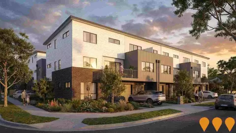
Denotes AI-based impression for illustrative purposes only, not to be taken as definitive under any circumstances. Please follow links and conduct other investigations from the project's source for actual imagery. Developers and project owners wishing us to use original imagery please Contact Us and we will do so.
Frequently Asked Questions - Infrastructure
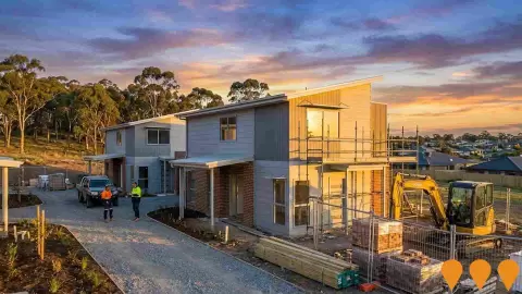
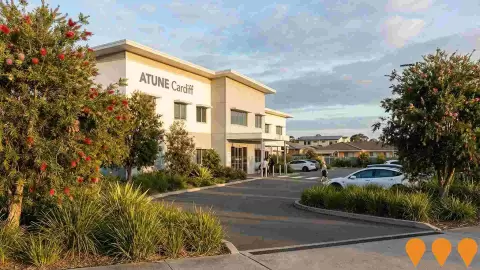
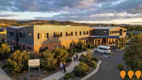
Tingira Hills Care Community
Tingira Hills Care Community (formerly Opal Hillside) is a major residential aged care facility in the Lake Macquarie region. It offers 120-128 beds across various room types including single en-suite and companion rooms, catering to permanent, respite, dementia, and palliative care needs. The facility features a dedicated Memory Care Neighborhood, a Wellness Centre for rehabilitation, an on-site cafe, hairdressing salon, and a community bus for outings. Architecturally, it was specifically engineered to manage variable founding conditions and ground movement associated with local mine subsidence.
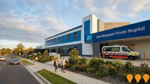
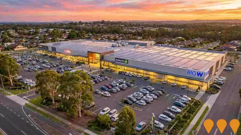
Lake Macquarie Square
A sub-regional shopping centre located in Mount Hutton, 14km from Newcastle's CBD. The project, originally a $60 million redevelopment completed in 2019 by Charter Hall, consolidated Lake Macquarie Fair and Mount Hutton Plaza into a single, modern retail destination with approximately 24,000 m2 of prime retail space. The centre is anchored by BIG W, Coles, and Woolworths, with over 70 specialty stores, a medical precinct, childcare, and a 24-hour gym. Revelop acquired the asset in February 2025 for $122.5 million.
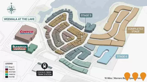
Costco Lake Macquarie Warehouse
The Costco Lake Macquarie Warehouse is a 14,000 sqm retail facility and fuel station located on the former Pasminco smelter site in Boolaroo, NSW. It opened on September 21, 2021, providing bulk retail services, contributing to local employment with over 225 jobs, and supporting the area's redevelopment.
Mount Hutton Precinct Area Plan
A precinct-specific planning framework forming Part 12 of the Lake Macquarie Development Control Plan 2014. Originally adopted by Council on 10 February 2020 to replace the 2004 plan, it sets controls for infrastructure delivery, built form and natural environment outcomes across the Mount Hutton suburb between Warners Bay and Belmont. The plan supports medium-density housing in the R3 zone south of Cowmeadow Road, road and roundabout upgrades, new shared pathways, stormwater works, and revegetation along Scrubby Creek. The framework has been progressively updated, most recently through the city-wide Housing Diversity amendments adopted by Council on 23 February 2026, which align the DCP with the Housing Diversity Planning Proposal that took effect on 1 August 2025. These reforms permit a broader mix of housing in R2 and R3 zones, allow subdivision down to 200 square metres in R3 and 250 square metres in R2, and remove minimum lot width requirements. A separate but related amendment finalised on 21 March 2025 rezoned 1 Progress Road from R2 Low Density Residential to E1 Local Centre, increasing the maximum building height on that site from 8.5 to 10 metres to support an expansion of the Dunkley Parade shops.
Lake Macquarie Bridge Replacement Program
Comprehensive program to replace and upgrade aging bridge infrastructure across Lake Macquarie to ensure safe and efficient transport connectivity.
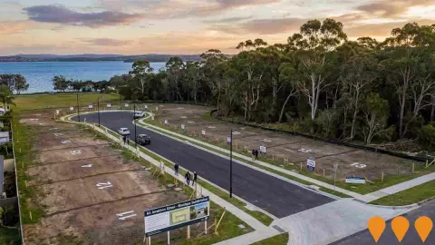
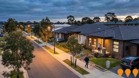
Ryhope Street Subdivision
A land subdivision master planned for 60 architecturally designed homes, creating a lifestyle community close to amenities as part of Lake Macquarie Council's Infill Housing Strategy. The majority of the new houses have been built through Cerretti's construction arm, WR Building & Property. The date of construction is listed as TBA (To Be Advised) on the developer's site, but the project is listed as a past project and sales data is available for units.
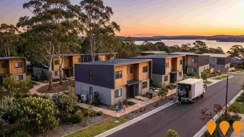
Lake Macquarie Modular Social Housing
Deployment of modular housing solutions to address social housing needs in the Lake Macquarie region, providing affordable accommodation options.
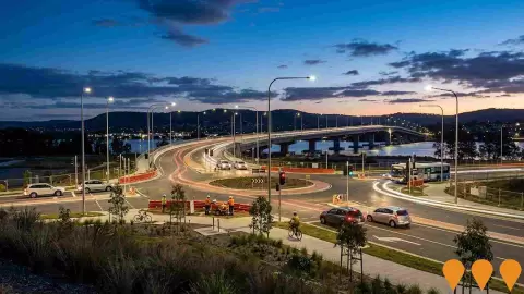
Speers Point Transport Improvements
A $16 million upgrade to the Speers Point transport network aimed at reducing travel times, improving safety, cutting congestion, and enhancing pedestrian and cycling connections. The key focus is improving the roundabout at Five Islands Road, T C Frith Avenue, and The Esplanade, and includes roundabout metering with traffic lights, dedicated turning lanes, and potential upgrades to nearby intersections. The concept design was open for community feedback until July 28, 2025, and preliminary investigations are underway.
Employment
AreaSearch analysis indicates Warners Bay maintains employment conditions that align with national benchmarks
The suburb of Warners Bay has a qualified labor force, with strong representation in key service sectors and an unemployment rate of just 3.1%, according to statistical area data compiled by AreaSearch. In March 2026, 4,232 residents were employed, showing an unemployment rate 1.0% below the Regional NSW rate of 4.1%, while labor force participation is close to the Regional NSW average of 60.6%. Census figures indicate that a high 26.6% of residents worked from home, although Covid-19 restrictions during that period should be kept in mind.
The primary sectors employing local residents are healthcare & social assistance, education & training, and retail trade. Conversely, the agricultural, forestry & fishing industry employs a mere 0.3% of workers locally, which is lower than the Regional NSW share of 5.3%. The ratio of 0.7 workers for every resident at the time of the Census indicates a higher level of local job opportunities than is typical.
According to AreaSearch analysis of SALM and ABS statistics aggregated from broader regions, the local labor force contracted by 1.0% alongside a 2.1% drop in employment during the year leading to March 2026, which pushed the unemployment rate up by 1.1 percentage points. By comparison, Regional NSW experienced a 0.9% drop in employment and a 0.4% contraction in the labor force, with a 0.5 percentage point increase in unemployment. Employment projections from Jobs and Skills Australia published in May-25 provide additional context regarding future demand. These forecasts, spanning five and ten-year horizons, have been compared against the local employment profile to project future trends. While nationwide employment is projected to grow by 6.6% over five years and 13.7% over ten years, the expected growth rates vary widely by industry. Applying these industry projections directly to the local employment distribution suggests that employment for residents of the suburb of Warners Bay will rise by 6.8% over five years and 14.2% over ten years, noting that this is a simple weighted extrapolation and does not adjust for local population forecasts.
Frequently Asked Questions - Employment
Income
Income levels sit below national averages according to AreaSearch assessment
According to the latest postcode-level ATO data compiled by AreaSearch for financial year 2023, the suburb of Warners Bay records a median taxpayer income of $51,897 and an average of $68,819. This sits slightly above the national average, contrasting with Regional NSW where the median is $52,390 and the average is $65,215. Factoring in Wage Price Index growth of 10.32% since financial year 2023, current estimates correspond to about $57,253 for the median and $75,921 for the average as of March 2026. In the 2021 Census, household, family, and personal incomes in the area ranked modestly, placing between the 35th and 42nd percentiles. Income distribution shows the largest group represents 28.1% of residents (2,384 people) earning within the $1,500 - 2,999 range, which aligns with broader metropolitan trends where 29.9% share this income level. Housing affordability pressures are marked, with only 83.5% of income remaining after housing costs, ranking in the 35th percentile, while the SEIFA income index places the area in the 6th decile.
Frequently Asked Questions - Income
Housing
Warners Bay displays a diverse mix of dwelling types, with above-average rates of outright home ownership
Housing types within the suburb of Warners Bay at the latest Census consisted of 67.8% separate houses and 32.2% other residential structures like townhouses and apartments, compared to Regional NSW which recorded 82.6% houses and 17.4% other dwellings. Outright home ownership in the suburb of Warners Bay was high at 45.3%, with the remaining properties being mortgaged (30.6%) or rented (24.0%). The median monthly mortgage payment was $2,058, which is higher than the Regional NSW median of $1,733, while the median weekly rent stood at $420 compared to Regional NSW's median of $330. Nationally, mortgage payments in the area are higher than the Australian average of $1,863, and weekly rents are above the national median of $375.
Frequently Asked Questions - Housing
Household Composition
Warners Bay has a typical household mix, with a lower-than-average median household size
Family households represent the main household type at 68.8% of the total, consisting of 25.6% couples with children, 29.8% couples without children, and 12.3% single parent families. Non-family households account for the remaining 31.2%, with lone person households making up 29.1% and group households representing 2.1%. The median household size of 2.3 individuals is slightly lower than the Regional NSW average of 2.4.
Frequently Asked Questions - Households
Local Schools & Education
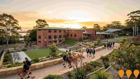
The educational profile of Warners Bay exceeds national averages, with above-average qualification levels and academic performance metrics
Educational credentials in the suburb of Warners Bay are slightly below statewide benchmarks, with 24.4% of residents aged 15+ holding a university degree compared to 32.2% across NSW. This variance points to opportunities for future skills development. Bachelor degrees are the most common higher qualification at 17.1%, followed by postgraduate degrees (4.9%) and graduate diplomas (2.4%). Vocational and technical training is common, with 38.8% of residents aged 15+ holding a vocational qualification, consisting of advanced diplomas (11.9%) and certificates (26.9%).
Enrolment rates are high, with 26.0% of the population participating in formal education. This group includes 8.7% in primary school, 7.4% in high school, and 4.0% enrolled in tertiary courses.
Frequently Asked Questions - Education
Schools Detail
Nearby Services & Amenities
Transport
Transport servicing is moderate compared to other areas nationally based on assessment of service frequency, route connectivity and accessibility
Analysis of local public transport options shows 145 active transit stops within the suburb of Warners Bay, consisting of bus services. These stops connect to 40 distinct routes, providing a total of 627 weekly passenger trips. Transport access is rated highly, with residents living an average of 158 meters from the nearest stop. Given the residential nature of the suburb of Warners Bay, many residents commute out of the area, with private cars being the primary mode of travel for 95% of commuters. Vehicle ownership stands at 1.3 cars per household, below the regional average, and 26.6% of residents worked from home according to the 2021 Census, which may reflect pandemic-era conditions.
The average frequency of public transport is 89 runs per day across the network, translating to about 4 weekly services for each transit stop. The map highlights the 100 closest transit stops to the central point of the area.
Frequently Asked Questions - Transport
Transport Stops Detail
Health
Health performance in Warners Bay is lower than average with common health conditions somewhat prevalent across the board, though to a slightly higher degree among older age cohorts
The suburb of Warners Bay presents notable health statistics, based on AreaSearch assessments of mortality rates and chronic health conditions. Common conditions are prevalent, particularly among older age brackets, while private health insurance coverage is high, with approximately 54% of the population (~4,594 people) holding policies, compared to 51.9% in Regional NSW.
Arthritis and mental health conditions are the most prevalent issues in the area, affecting 10.9% and 9.9% of residents respectively. Conversely, 61.3% of the population reported no chronic medical conditions, compared to 63.3% across Regional NSW. Working-age residents display higher than average rates of chronic health issues. The suburb of Warners Bay has a mature demographic with 27.3% of residents aged 65 and over (2,316 people), compared to 23.4% in Regional NSW. Health profiles for senior residents show some challenges, though they rank more favorably nationally than the overall local population.
Frequently Asked Questions - Health
Cultural Diversity
Warners Bay is considerably less culturally diverse than average when assessed alongside AreaSearch's national rankings for language and cultural background related metrics
The suburb of Warners Bay displays lower levels of cultural diversity than average, with 87.4% of its residents born in Australia, 93.0% holding citizenship, and 94.4% speaking only English at home. The predominant religion is Christianity, accounting for 55.6% of residents, which is close to the Regional NSW average of 55.9%.
Regarding parental birthplace and ancestry, the three largest groups in the suburb of Warners Bay are English at 32.8%, Australian at 29.7%, and Scottish at 8.9%. There are also specific differences in the proportion of other ancestries: Polish ancestry is represented at 1.1% (compared to 0.5% regionally), Macedonian at 0.6% (compared to 0.4%), and Welsh at 0.7% (compared to 0.5%).
Frequently Asked Questions - Diversity
Age
Warners Bay hosts an older demographic, ranking in the top quartile nationwide
The suburb of Warners Bay has a median age of 46, which is older than the Regional NSW median of 43 and higher than the national median of 38. The 75 - 84 age cohort is highly represented at 10.4% compared to Regional NSW, while the 25 - 34 cohort is smaller at 9.3%. Post-2021 Census data reveals the 75 to 84 age bracket expanded from 9.3% to 10.4% of the population, whereas the 45 to 54 cohort decreased from 13.7% to 12.4%. By 2041, the age structure of the suburb of Warners Bay is projected to shift, with the 85+ bracket growing by 65% (220 people) to reach 560 from 339, while the 55 to 64 and 15 to 24 brackets are expected to contract.